Historical Pubs of London Map von Will Noble Karte (gefalzt) 2026 | Blue Crow Media ISBN: 9781912018161 CHF 17,35 (inkl. MwSt) Noch nicht erschienen
Women's History New York Map Guide to Historic Women in New York von Allison C. Meier Karte (gefalzt) 2026 | Blue Crow Media ISBN: 9781912018017 CHF 17,35 (inkl. MwSt) Noch nicht erschienen
Discovering Glasgow Illustrated Map Ideal for Exploring von Dominic Beddow Karte (gefalzt) 2023 | Collins ISBN: 9780008602901 CHF 16,90 (inkl. MwSt) Versand in 10-20 Tagen
An Historical Map of Bradford Wool Capital of the World von Ian Roberts Karte (gefalzt) 2025 | The Historic Towns Trust ISBN: 9781068709111 CHF 24,90 (inkl. MwSt) Versand in 10-20 Tagen
Vom Wandel der Leipziger Vorstädte 300 verlorene Bauten aus 160 Jahren von Sebastian Ringel Karte/Kartografie 2022 | Auflage: 1 | edition überland.. ISBN: 9783948049126 CHF 41,25 (inkl. MwSt) Versand in 10-15 Tagen
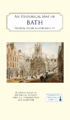
An Historical Map of Bath Medieval, Stuart and Georgian city von History of Bath Research Group Karte (gefalzt) 2024 | The Historic Towns Trust ISBN: 9781838071967 CHF 20,90 (inkl. MwSt) Versand in 10-20 Tagen
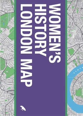
Women's History London Map Guide to Historical Women in London von Katie Wignall Karte (gefalzt) 2024 | Blue Crow Media ISBN: 9781912018116 CHF 21,90 (inkl. MwSt) Versand in 10-20 Tagen
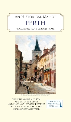
An Historical Map of Perth Royal burgh and county town von Perthshire Society of Natural Science; John Jessop Karte (gefalzt) 2024 | The Historic Towns Trust ISBN: 9781838071974 CHF 20,90 (inkl. MwSt) Versand in 10-20 Tagen
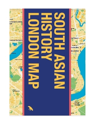
South Asian History London Map Guide to South Asian Historical Landmarks and Figures in London von Bushra Mohamed; Krish Nathaniel Karte (gefalzt) 2024 | Blue Crow Media ISBN: 9781912018109 CHF 17,35 (inkl. MwSt) Versand in 10-20 Tagen
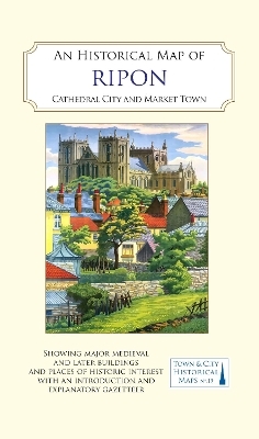
An Historical Map of Ripon Cathedral City and Market Town von Mick Stanley; Ripon Together Karte (gefalzt) 2024 | The Historic Towns Trust ISBN: 9781838071981 CHF 20,90 (inkl. MwSt) Versand in 10-20 Tagen
An Historical Map of Chester Mercantile Centre and Cathedral City von Thomas Pickles; Katherine Wilson Karte (gefalzt) 2025 | The Historic Towns Trust ISBN: 9781838071998 CHF 20,90 (inkl. MwSt) Versand in 10-20 Tagen
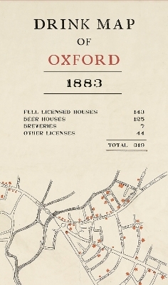
Drink Map of Oxford Karte (gefalzt) 2019 | Bodleian Library ISBN: 9781851245352 CHF 18,35 (inkl. MwSt) Versand in 10-15 Tagen
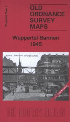
Wuppertal-Barmen 1945 Wuppertal Sheet 2 von Alan Godfrey Karte (gefalzt) 2014 | Alan Godfrey Maps ISBN: 9781847848116 CHF 11,90 (inkl. MwSt) sofort lieferbar
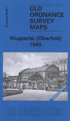
Wuppertal (Elberfeld) 1945 Wuppertal Sheet 1 von Alan Godfrey Karte (gefalzt) 2014 | Alan Godfrey Maps ISBN: 9781847847737 CHF 11,90 (inkl. MwSt) sofort lieferbar
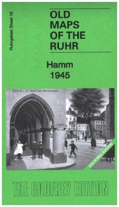
Hamm 1945 Ruhr Sheet 19 von Alan Godfrey Karte (gefalzt) 2014 | Alan Godfrey Maps ISBN: 9781847848543 CHF 11,90 (inkl. MwSt) sofort lieferbar
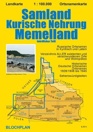
Landkarte Samland/Kurische Nehrung/Memelland Memelland (nördlicher Teil) von Dirk Bloch Karte (gefalzt) 2020 | Auflage: 1 | BLOCHPLAN ISBN: 9783982024363 CHF 15,90 (inkl. MwSt) Versand in 2-3 Tagen
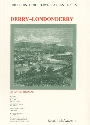
Derry~Londonderry Irish Historic Towns Atlas, no. 15 von Dr Avril Thomas Karte (gefalzt) 2005 | Royal Irish Academy ISBN: 9781904890133 CHF 48,85 (inkl. MwSt) Versand in 15-20 Tagen
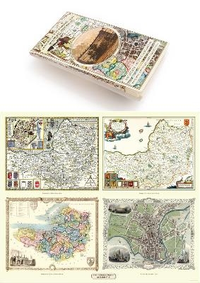
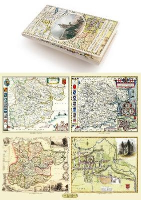
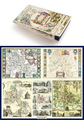
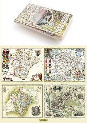
Gloucestershire 1611 – 1836 – Fold Up Map that features a collection of Four Historic.. von Mapseeker Publishing Ltd. Karte (gefalzt) 2014 | Mapseeker Archive Publishing ISBN: 9781844918287 CHF 36,70 (inkl. MwSt) Versand in 10-20 Tagen
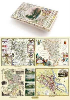
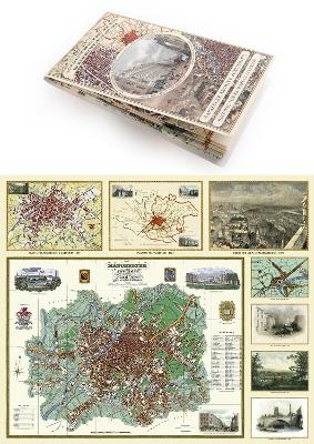
Derbyshire 1610 – 1836 – Fold Up Map that features a collection of Four Historic Maps,.. von Mapseeker Publishing Ltd. Karte (gefalzt) 2014 | Mapseeker Archive Publishing ISBN: 9781844918348 CHF 36,70 (inkl. MwSt) Versand in 15-20 Tagen
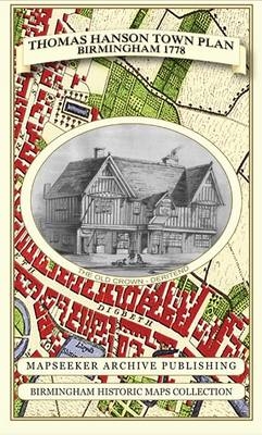
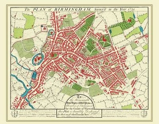
Thomas Hanson Town Plan of Birmingham 1778 von Thomas Hanson; Mapseeker Publishing Ltd. Karte (gefalzt) 2013 | Mapseeker Archive Publishing ISBN: 9781844918096 CHF 36,70 (inkl. MwSt) Versand in 10-20 Tagen
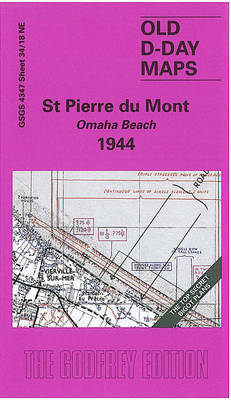
St. Pierre Du Mont (Omaha Beach) 1944 D-Day Sheet 34/18 von Tony Rosser Karte (gefalzt) 2004 | Alan Godfrey Maps ISBN: 9781841516530 CHF 13,15 (inkl. MwSt) Versand in 10-14 Tagen
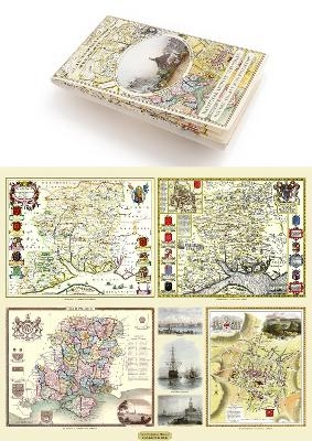
Somersetshire 1611 – 1836 – Fold Up Map that features a collection of Four Historic Maps,.. von Mapseeker Publishing Ltd. Karte (plano) 2014 | Mapseeker Archive Publishing ISBN: 9781844918355 CHF 36,70 (inkl. MwSt) Versand in 10-20 Tagen
Essex 1610 – 1836 – Fold Up Map that features a collection of Four Historic Maps, John.. von Mapseeker Publishing Ltd. Karte (gefalzt) 2014 | Mapseeker Archive Publishing ISBN: 9781844918300 CHF 36,70 (inkl. MwSt) Versand in 15-20 Tagen
Hampshire 1610 – 1836 – Fold Up Map that features a collection of Four Historic Maps,.. von Mapseeker Publishing Ltd. Karte (gefalzt) 2014 | Mapseeker Archive Publishing ISBN: 9781844918294 CHF 36,70 (inkl. MwSt) Versand in 15-20 Tagen
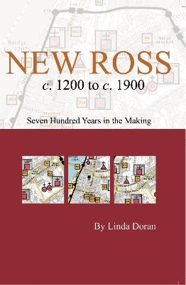
New Ross c. 1200 to c. 1900: seven hundred years in the making von Dr Linda Doran Karte (gefalzt) 2007 | Royal Irish Academy ISBN: 9781904890324 CHF 26,15 (inkl. MwSt) Versand in 15-20 Tagen
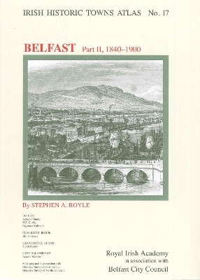
Belfast, part II, 1840 to 1900 Irish Historic Towns Atlas, no. 17 von Professor Stephen A. Royle Karte (gefalzt) 2007 | Royal Irish Academy ISBN: 9781904890263 CHF 52,35 (inkl. MwSt) Versand in 15-20 Tagen
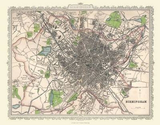
Plan of Birmingham 1866 by Archibold Fullarton 20" x 16" Photographic Print von Archibold Fullarton Karte (gerollt) 2010 | Mapseeker Archive Publishing ISBN: 9781844910144 CHF 38,40 (inkl. MwSt) Versand in 15-20 Tagen
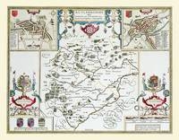
John Speed Map of Rutland 1611 20" x 16" Photographic Print of the County of Rutlandshire - England von John Speed Karte (gerollt) 2010 | Historical Images Ltd ISBN: 9781844910335 CHF 38,40 (inkl. MwSt) Versand in 15-20 Tagen
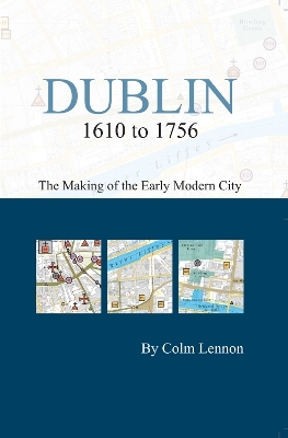
Dublin 1610 to 1756: the making of the early modern city von Professor Colm Lennon Karte (gefalzt) 2009 | Royal Irish Academy ISBN: 9781904890614 CHF 17,45 (inkl. MwSt) Versand in 15-20 Tagen
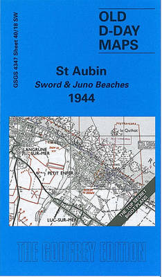
St. Aubin - Sword and Juno Beaches 1944 von Tony Painter Karte (gefalzt) 2004 | Alan Godfrey Maps ISBN: 9781841516929 CHF 13,15 (inkl. MwSt) Versand in 10-20 Tagen
Kent County 1611 – 1836 – Fold Up Map that features a collection of Four Historic Maps,.. von Mapseeker Publishing Ltd. Karte (gefalzt) 2014 | Mapseeker Archive Publishing ISBN: 9781844918317 CHF 36,70 (inkl. MwSt) Versand in 15-20 Tagen
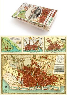
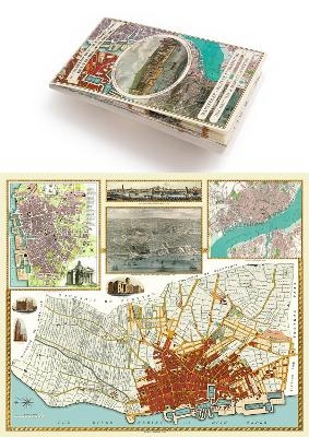
Liverpool 1650 to 1821 - Fold Up Map Containing Town Plans of Liverpool that include.. von Mapseeker Publishing Ltd. Karte (gefalzt) 2014 | Mapseeker Archive Publishing ISBN: 9781844918232 CHF 36,70 (inkl. MwSt) Versand in 10-20 Tagen
Cambridgeshire 1611 - 1836 - Fold Up Map that includes Four Historic Maps of.. von Mapseeker Publishing Ltd. Karte (gefalzt) 2013 | Mapseeker Archive Publishing ISBN: 9781844918157 CHF 36,70 (inkl. MwSt) Versand in 10-20 Tagen
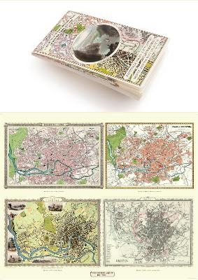
A Bristol 1851-1903 - Fold up Map that consists of Four Detailed Street Plans, Bristol.. von Mapseeker Publishing Ltd. Karte (gefalzt) 2013 | Mapseeker Archive Publishing ISBN: 9781844918171 CHF 36,70 (inkl. MwSt) Versand in 15-20 Tagen
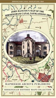
John Hancox's Map of the Birmingham Canal Navigations 1864 von John Hancox; Mapseeker Publishing Ltd. Karte (gefalzt) 2013 | Mapseeker Archive Publishing ISBN: 9781844918126 CHF 36,70 (inkl. MwSt) Versand in 10-20 Tagen
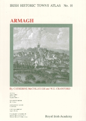
Armagh Irish Historic Towns Atlas, no. 18 von Catherine McCullough; W.H. Crawford Karte (gefalzt) 2007 | Royal Irish Academy ISBN: 9781904890188 CHF 48,85 (inkl. MwSt) Versand in 15-20 Tagen
John Speed Map of Shropshire 1611 20" x 16" Photographic Print of the County of Shropshire - England von John Speed Karte (gerollt) 2010 | Historical Images Ltd ISBN: 9781844910342 CHF 38,40 (inkl. MwSt) Versand in 15-20 Tagen
Manchester 1650 - 1876 - Fold Up Map featuring William Swire's Plan of Manchester and.. von Mapseeker Publishing Ltd. Karte (gefalzt) 2014 | Mapseeker Archive Publishing ISBN: 9781844918324 CHF 36,70 (inkl. MwSt) Versand in 10-20 Tagen
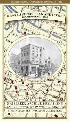
James Drake's Street Plan and Index of Birmingham 1832 von James Drake; Mapseeker Publishing Ltd. Karte (gefalzt) 2013 | Mapseeker Archive Publishing ISBN: 9781844918133 CHF 36,70 (inkl. MwSt) Versand in 10-20 Tagen
A Oxfordshire 1611 – 1836 – Fold Up Map that features a collection of Four Historic Maps,.. von Mapseeker Publishing Ltd. Karte (gefalzt) 2013 | Mapseeker Archive Publishing ISBN: 9781844918140 CHF 36,70 (inkl. MwSt) Versand in 10-20 Tagen
Cornwall 1611 – 1836 – Fold Up Map that features a collection of Four Historic Maps, John.. von Mapseeker Publishing Ltd. Karte (gefalzt) 2014 | Mapseeker Archive Publishing ISBN: 9781844918256 CHF 36,70 (inkl. MwSt) Versand in 15-20 Tagen
Liverpool 1785-1903 - Fold up Map that includes Charles Eyes detailed Plan of the.. von Mapseeker Publishing Ltd. Karte (gefalzt) 2014 | Mapseeker Archive Publishing ISBN: 9781844918249 CHF 36,70 (inkl. MwSt) Versand in 10-20 Tagen
Devon 1611 – 1836 – Fold Up Map that features a collection of Four Historic Maps, John.. von Mapseeker Publishing Ltd. Karte (gefalzt) 2014 | Mapseeker Archive Publishing ISBN: 9781844918263 CHF 36,70 (inkl. MwSt) Versand in 10-20 Tagen
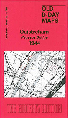
Ouistreham - Pegasus Bridge 1944 D-Day Sheet 40/16 von Tony Painter Karte (gefalzt) 2004 | Alan Godfrey Maps ISBN: 9781841516257 CHF 13,15 (inkl. MwSt) Versand in 10-14 Tagen
Plan of Birmingham 1731 by William Westley 20" x 16" Photographic Print von William Westley Karte (gerollt) 2010 | Mapseeker Archive Publishing ISBN: 9781844910137 CHF 38,40 (inkl. MwSt) Versand in 15-20 Tagen
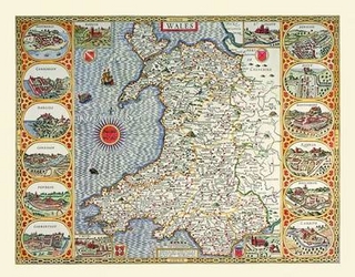
John Speed Map of Wales 1611 20" x 16" Photographic Print von John Speed; Historical Images Ltd Karte (gerollt) 2010 | Historical Images Ltd ISBN: 9781844910151 CHF 29,65 (inkl. MwSt) Versand in 15-20 Tagen
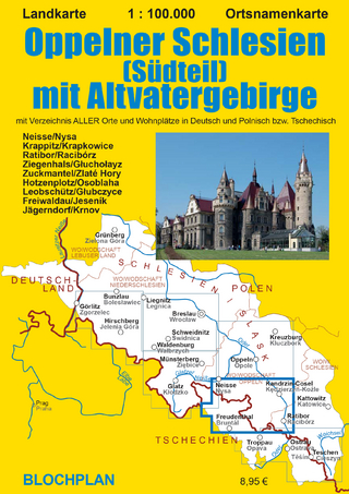
Landkarte Oppelner Schlesien (Südteil) mit Altvatergebirge Ortsnamenkarte im Maßstab 1:100.000 von Dirk Bloch Karte (gefalzt) 2020 | Auflage: 1 | BLOCHPLAN ISBN: 9783982024349 CHF 14,90 (inkl. MwSt) Versand in 2-3 Tagen
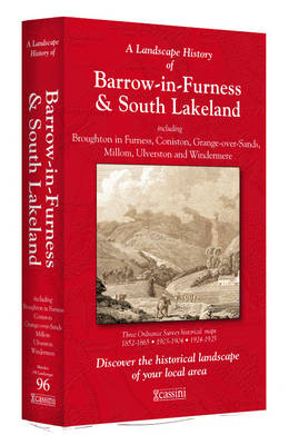
A Landscape History of Barrow-in-Furness & South Lakeland (1852-1925) - LH3-096 Three Historical Ordnance Survey Maps Karte (gefalzt) 2011 | Cassini Publishing Ltd ISBN: 9781847368355 CHF 78,55 (inkl. MwSt) Versand in 10-20 Tagen
Koln (S) 1944 Cologne Sheet 2 von Alan Godfrey Karte (gefalzt) 2015 | Alan Godfrey Maps ISBN: 9781847849465 CHF 11,90 (inkl. MwSt) sofort lieferbar
Koln (N) 1944 Cologne Sheet 1 von Alan Godfrey Karte (gefalzt) 2015 | Alan Godfrey Maps ISBN: 9781847849458 CHF 11,90 (inkl. MwSt) sofort lieferbar