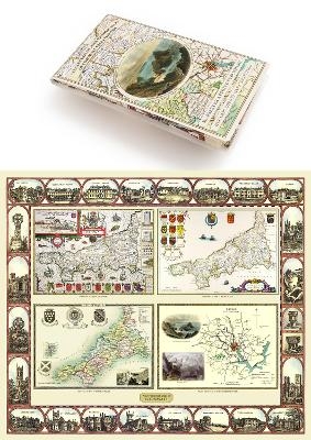
Cornwall 1611 – 1836 – Fold Up Map that features a collection of Four Historic Maps, John Speed’s County Map 1611, Johan Blaeu’s County Map of 1648, Thomas Moules County Map of 1836 and Robert Dawson’s Reform Act Plan of Truro 1831. The maps are surrounded by Cornwall’s Historic Buildings.
Seiten
2014
Mapseeker Archive Publishing (Verlag)
978-1-84491-825-6 (ISBN)
Mapseeker Archive Publishing (Verlag)
978-1-84491-825-6 (ISBN)
| Erscheint lt. Verlag | 18.11.2014 |
|---|---|
| Reihe/Serie | Historic Counties Map Collection |
| Verlagsort | Truro |
| Sprache | englisch |
| Maße | 134 x 237 mm |
| Themenwelt | Sachbuch/Ratgeber ► Geschichte / Politik ► Regional- / Landesgeschichte |
| Geisteswissenschaften ► Geschichte ► Hilfswissenschaften | |
| ISBN-10 | 1-84491-825-4 / 1844918254 |
| ISBN-13 | 978-1-84491-825-6 / 9781844918256 |
| Zustand | Neuware |
| Informationen gemäß Produktsicherheitsverordnung (GPSR) | |
| Haben Sie eine Frage zum Produkt? |