Ordnance Survey Maps von David & Charles Publishing Karte (gefalzt) 1982 | David & Charles ISBN: 9780715348284 CHF 8,50 (inkl. MwSt) Keine Verlagsinformationen verfügbar
Ordnance Survey Maps von David & Charles Publishing Karte (gefalzt) 1983 | David & Charles ISBN: 9780715346440 CHF 8,50 (inkl. MwSt) Keine Verlagsinformationen verfügbar
Ordnance Survey Maps von David & Charles Publishing Karte (gefalzt) 1983 | David & Charles ISBN: 9780715346013 CHF 8,50 (inkl. MwSt) Keine Verlagsinformationen verfügbar
Ordnance Survey Maps von David & Charles Publishing Karte (gefalzt) 1983 | David & Charles ISBN: 9780715344996 CHF 8,50 (inkl. MwSt) Keine Verlagsinformationen verfügbar
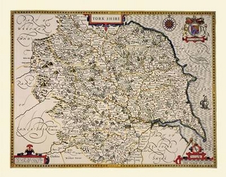
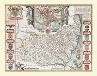
John Speed Map of Yorkshire 1611 20" x 16" Photographic Print of the County of Yorkshire - England von John Speed Karte (gerollt) 2010 | Historical Images Ltd ISBN: 9781844910182 CHF 38,40 (inkl. MwSt) Keine Verlagsinformationen verfügbar
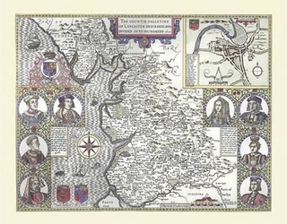
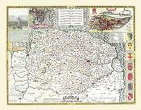
John Speed Map of Lancashire 1611 20" x 16" Photographic Print of the County of Lancashire - England von John Speed Karte (gerollt) 2010 | Historical Images Ltd ISBN: 9781844910168 CHF 38,40 (inkl. MwSt) Keine Verlagsinformationen verfügbar
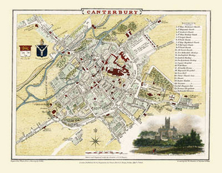
Cole and Roper Old Map of Canterbury1806 20" x 16" Photographic Print of City of Canterbury von Cole and Roper Karte (plano) 2010 | Mapseeker Archive Publishing ISBN: 9781844910922 CHF 38,40 (inkl. MwSt) Keine Verlagsinformationen verfügbar
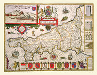
John Speed Map of Cornwall 1611 20" x 16" Photographic Print of the County of Cornwall - England von John Speed Karte (plano) 2010 | Historical Images Ltd ISBN: 9781844910403 CHF 38,40 (inkl. MwSt) Keine Verlagsinformationen verfügbar
John Speed Map of Lincolnshire 1611 20" x 16" Photographic Print of the County of Lincolnshire - England von John Speed Karte (plano) 2010 | Historical Images Ltd ISBN: 9781844910496 CHF 38,40 (inkl. MwSt) Keine Verlagsinformationen verfügbar
John Speed Map of Northamptonshire 1611 20" x 16" Photographic Print of the County of Northamptonshire - England von John Speed Karte (plano) 2010 | Historical Images Ltd ISBN: 9781844910304 CHF 38,40 (inkl. MwSt) Keine Verlagsinformationen verfügbar
John Speed Map of Sussex 1611 20" x 16" Photographic Print of the County of Sussex - England von John Speed Karte (plano) 2010 | Historical Images Ltd ISBN: 9781844910533 CHF 38,40 (inkl. MwSt) Keine Verlagsinformationen verfügbar
John Speed Map of Durham 1611 20" x 16" Photographic Print of the County of Durham - England von John Speed Karte (plano) 2010 | Historical Images Ltd ISBN: 9781844910458 CHF 38,40 (inkl. MwSt) Keine Verlagsinformationen verfügbar
John Speed Map of Suffolk 1611 20" x 16" Photographic Print of the County of Suffolk - England von John Speed Karte (plano) 2010 | Historical Images Ltd ISBN: 9781844910526 CHF 38,40 (inkl. MwSt) Keine Verlagsinformationen verfügbar
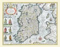
John Speed Map of Ireland 1611 20" x 16" Photographic Print of Ireland von John Speed Karte (plano) 2010 | Historical Images Ltd ISBN: 9781844910557 CHF 38,40 (inkl. MwSt) Keine Verlagsinformationen verfügbar
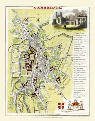
Cole and Roper Old Map of Cambridge 1804 20" x 16" Photographic Print of Cambridge von Cole and Roper Karte (plano) 2010 | Mapseeker Archive Publishing ISBN: 9781844910977 CHF 38,40 (inkl. MwSt) Keine Verlagsinformationen verfügbar
John Speed Map of Devonshire 1611 20" x 16" Photographic Print of the County of Devon - England von John Speed Karte (plano) 2010 | Historical Images Ltd ISBN: 9781844910427 CHF 38,40 (inkl. MwSt) Keine Verlagsinformationen verfügbar
John Speed Map of Norfolk 1611 20" x 16" Photographic Print of the County of Norfolk - England von John Speed Karte (plano) 2010 | Historical Images Ltd ISBN: 9781844910502 CHF 38,40 (inkl. MwSt) Keine Verlagsinformationen verfügbar
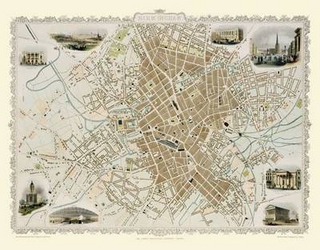
John Tallis Map of Birmingham 1851 20" x 16" Photographic Print of Birmingham von John Tallis Karte (plano) 2010 | Mapseeker Archive Publishing ISBN: 9781844910113 CHF 38,40 (inkl. MwSt) Keine Verlagsinformationen verfügbar
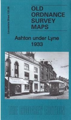
Ashton Under Lyne 1933 Lancashire Sheet 105.06C von Alan Godfrey Karte (gefalzt) 2017 | Alan Godfrey Maps ISBN: 9781787210363 Keine Verlagsinformationen verfügbar
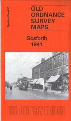
Gosforth 1941 Tyneside Sheet 30b von Alan Godfrey Karte (gefalzt) 2017 | Alan Godfrey Maps ISBN: 9781787210769 Titel nicht im Sortiment