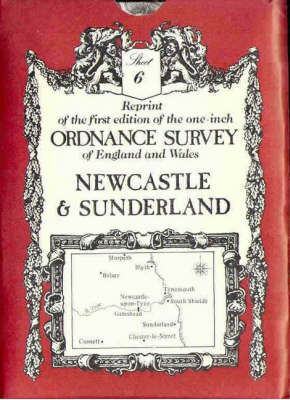
Ordnance Survey Maps von David & Charles Publishing Karte (gefalzt) 1983 | David & Charles ISBN: 9780715350966 CHF 8,50 (inkl. MwSt) Keine Verlagsinformationen verfügbar
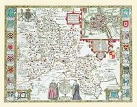
John Speed Map of Hertfordshire 1611 20" x 16" Photographic Print of the County of Hertfordshire - England von John Speed Karte (plano) 2010 | Historical Images Ltd ISBN: 9781844910267 CHF 38,40 (inkl. MwSt) Keine Verlagsinformationen verfügbar
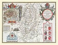
John Speed Map of Nottinghamshire 1611 20" x 16" Photographic Print of the County of Nottinghamshire - England von John Speed Karte (plano) 2010 | Historical Images Ltd ISBN: 9781844910311 CHF 38,40 (inkl. MwSt) Keine Verlagsinformationen verfügbar
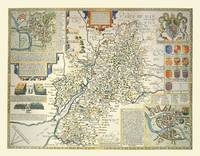
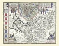
John Speed Map of Gloucestershire 1611 20" x 16" Photographic Print of the County of Gloucestershire - England von John Speed Karte (plano) 2010 | Historical Images Ltd ISBN: 9781844910243 CHF 38,40 (inkl. MwSt) Keine Verlagsinformationen verfügbar
John Speed Map of Oxfordshire 1611 20" x 16" Photographic Print of the County of Oxfordshire - England von John Speed Karte (plano) 2010 | Historical Images Ltd ISBN: 9781844910328 CHF 38,40 (inkl. MwSt) Keine Verlagsinformationen verfügbar
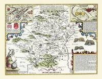
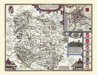
John Speed Map of Herefordshire 1611 20" x 16" Photographic Print of the County of Herefordshire - England von John Speed Karte (plano) 2010 | Historical Images Ltd ISBN: 9781844910250 CHF 38,40 (inkl. MwSt) Keine Verlagsinformationen verfügbar
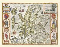
John Speed Map of Scotland 1611 20" x 16" Photographic Print of Map of Scotland von John Speed Karte (plano) 2010 | Historical Images Ltd ISBN: 9781844910540 CHF 38,40 (inkl. MwSt) Keine Verlagsinformationen verfügbar
John Speed Map of Hampshire 1611 20" x 16" Photographic Print of the County of Hampshire - England von John Speed Karte (plano) 2010 | Historical Images Ltd ISBN: 9781844910472 CHF 38,40 (inkl. MwSt) Keine Verlagsinformationen verfügbar
John Speed Map of Cheshire 1611 20" x 16" Photographic Print of the County of Cheshire - England von John Speed Karte (plano) 2010 | Historical Images Ltd ISBN: 9781844910397 CHF 38,40 (inkl. MwSt) Keine Verlagsinformationen verfügbar
Consett 1939 County Durham Sheet 11.14c von Tom Hutchinson Karte (gefalzt) 2022 | Alan Godfrey Maps ISBN: 9781787215221 Titel nicht im Sortiment
Langley Green & South Oldbury 1914 Staffordshire Sheet 72.02 von Mike Jee Karte (gefalzt) 2017 | Alan Godfrey Maps ISBN: 9781787210608 Titel nicht im Sortiment
New Delph & Tame Water 1916 Lancashire Sheet 97.04 von Chris Makepeace Karte (gefalzt) 2022 | Alan Godfrey Maps ISBN: 9781787215528 Titel nicht im Sortiment
Old Wolverton 1898 Buckinghamshire sheet 9.11 von Barrie Trinder Karte (gefalzt) 2022 | Alan Godfrey Maps ISBN: 9781787215344 Titel nicht im Sortiment
Cleator Moor 1923 Cumberland Sheet 67.12 von Barrie Trinder Karte (gefalzt) 2022 | Alan Godfrey Maps ISBN: 9781787215368 Titel nicht im Sortiment
Mablethorpe 1888 Lincolnshire Sheet 58.05 von Alan Godfrey Karte (gefalzt) 2022 | Alan Godfrey Maps ISBN: 9781787215269 Titel nicht im Sortiment
Millom 1897 Cumberland Sheet 90.03 von Barrie Trinder Karte (gefalzt) 2022 | Alan Godfrey Maps ISBN: 9781787215429 Titel nicht im Sortiment
Grays (North) 1916 Essex Sheet 95.02 von Tony Kirby Karte (gefalzt) 2022 | Alan Godfrey Maps ISBN: 9781787215436 Titel nicht im Sortiment
Edge Hill 1925 Lancashire Sheet 106.15b von Kay Parrott Karte (gefalzt) 2022 | Alan Godfrey Maps ISBN: 9781787215535 Titel nicht im Sortiment
Lye 1901 Worcestershire Sheet 4.11a von Alan Godfrey Karte (gefalzt) 2022 | Alan Godfrey Maps ISBN: 9781787215658 Titel nicht im Sortiment
Cradley Heath, Old Hill & Dudley Wood 1914 Staffordshire Sheet 71.06c von Barrie Trinder Karte (gefalzt) 2022 | Alan Godfrey Maps ISBN: 9781787215405 Titel nicht im Sortiment