


Philip's Road Map Ireland
Seiten
2006
Philip's (Verlag)
978-0-540-08944-4 (ISBN)
Philip's (Verlag)
978-0-540-08944-4 (ISBN)
- Titel erscheint in neuer Auflage
- Artikel merken
Zu diesem Artikel existiert eine Nachauflage
A new edition of our folded sheet map covering the whole of Ireland.
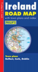
A brand new edition of Philip's folded sheet map covering the whole of Ireland.The whole of Ireland is shown on one side of the sheet, along with a comprehensive index and town centre plans. The map has been specifically prepared for touring, at an ideal size and scale for easy planning and route-finding. The folded format is convenient for in-car use.The fully updated digital mapping gives excellent clarity at 9 miles to one inch. Road networks are shown in exceptional detail, picking out major routes and destinations in bold colours for easy route-planning, plus town plans of Dublin, Cork, Belfast, Derry/Londonderry.High quality travel information provides a wealth of useful detail marking car ferries, national parks, beaches, cathedrals, castles, ancient monuments and many other places of interest.Main map scale: 9 miles to 1 inch
A brand new edition of Philip's folded sheet map covering the whole of Ireland.The whole of Ireland is shown on one side of the sheet, along with a comprehensive index and town centre plans. The map has been specifically prepared for touring, at an ideal size and scale for easy planning and route-finding. The folded format is convenient for in-car use.The fully updated digital mapping gives excellent clarity at 9 miles to one inch. Road networks are shown in exceptional detail, picking out major routes and destinations in bold colours for easy route-planning, plus town plans of Dublin, Cork, Belfast, Derry/Londonderry.High quality travel information provides a wealth of useful detail marking car ferries, national parks, beaches, cathedrals, castles, ancient monuments and many other places of interest.Main map scale: 9 miles to 1 inch
| Verlagsort | London |
|---|---|
| Sprache | englisch |
| Maße | 133 x 250 mm |
| Gewicht | 87 g |
| Themenwelt | Reisen ► Karten / Stadtpläne / Atlanten ► Europa |
| ISBN-10 | 0-540-08944-3 / 0540089443 |
| ISBN-13 | 978-0-540-08944-4 / 9780540089444 |
| Zustand | Neuware |
| Informationen gemäß Produktsicherheitsverordnung (GPSR) | |
| Haben Sie eine Frage zum Produkt? |
Mehr entdecken
aus dem Bereich


aus dem Bereich
Buch | Leporello (2025)
Kompass-Karten (Verlag)
CHF 21,90