


Philip's Road Map Ireland
Seiten
2003
Philip's (Verlag)
978-0-540-08532-3 (ISBN)
Philip's (Verlag)
978-0-540-08532-3 (ISBN)
- Titel ist leider vergriffen;
keine Neuauflage - Artikel merken
Zu diesem Artikel existiert eine Nachauflage
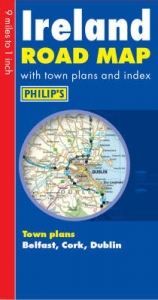
The whole of Ireland is shown on one side of the sheet to give continuous coverage of the country.
A brand new edition of Philip's road map covering the whole of Ireland.Ireland is shown on one side of the sheet, giving continuous coverage. The map has been specifically prepared for tourism and long-distance travel, allowing for easy planning and route-finding and also features indexed town plans of Belfast, Cork, Derry/Londonderry and Dublin. The map is also ideally suited for office use, eg for sales territory planning.The map features Philip's superb cartography giving excellent clarity at 9 miles to one inch. The mapping gives excellent coverage of the road network, showing all major roads, and includes airports and ferries.Also available as a laminated wall map, rolled in a tube, for office use.Main map scale: 9 miles to 1 inch
A brand new edition of Philip's road map covering the whole of Ireland.Ireland is shown on one side of the sheet, giving continuous coverage. The map has been specifically prepared for tourism and long-distance travel, allowing for easy planning and route-finding and also features indexed town plans of Belfast, Cork, Derry/Londonderry and Dublin. The map is also ideally suited for office use, eg for sales territory planning.The map features Philip's superb cartography giving excellent clarity at 9 miles to one inch. The mapping gives excellent coverage of the road network, showing all major roads, and includes airports and ferries.Also available as a laminated wall map, rolled in a tube, for office use.Main map scale: 9 miles to 1 inch
| Erscheint lt. Verlag | 26.8.2003 |
|---|---|
| Verlagsort | London |
| Sprache | englisch |
| Maße | 2 x 2 mm |
| Gewicht | 10 g |
| Themenwelt | Reisen ► Karten / Stadtpläne / Atlanten ► Europa |
| ISBN-10 | 0-540-08532-4 / 0540085324 |
| ISBN-13 | 978-0-540-08532-3 / 9780540085323 |
| Zustand | Neuware |
| Informationen gemäß Produktsicherheitsverordnung (GPSR) | |
| Haben Sie eine Frage zum Produkt? |
Mehr entdecken
aus dem Bereich


aus dem Bereich
Buch | Leporello (2025)
Kompass-Karten (Verlag)
CHF 21,90