


Philip's Ireland Road Map
Seiten
2008
Philip's (Verlag)
978-0-540-09331-1 (ISBN)
Philip's (Verlag)
978-0-540-09331-1 (ISBN)
- Titel erscheint in neuer Auflage
- Artikel merken
Zu diesem Artikel existiert eine Nachauflage
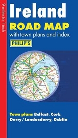
A map that shows the whole of Ireland at a scale of 9 miles to 1 inch. It includes a comprehensive index of place names, and town plans of Belfast, Cork, Derry/Londonderry and Dublin, with tourist information marked.
"Philip's Ireland Road Map" shows the whole of Ireland at a scale of 9 miles to 1 inch (1 cm on the map = 5.5 km on the ground). The map includes a comprehensive index of place names, plus detailed town plans of Belfast, Cork, Derry/Londonderry and Dublin, with tourist information clearly marked. The map has been specially prepared for touring, picking out major routes and destinations in bold colours for easy journey planning and route-finding, and is a convenient size for use in a vehicle. The digital mapping gives excellent clarity, showing road networks in exceptional detail for this scale. High-quality travel information includes a wealth of useful detail marking car ferries, national parks, historic houses and gardens, museums, cathedrals, castles, ancient monuments, theme parks, and many other places of interest. A comprehensive index includes all towns and villages shown on the map.
"Philip's Ireland Road Map" shows the whole of Ireland at a scale of 9 miles to 1 inch (1 cm on the map = 5.5 km on the ground). The map includes a comprehensive index of place names, plus detailed town plans of Belfast, Cork, Derry/Londonderry and Dublin, with tourist information clearly marked. The map has been specially prepared for touring, picking out major routes and destinations in bold colours for easy journey planning and route-finding, and is a convenient size for use in a vehicle. The digital mapping gives excellent clarity, showing road networks in exceptional detail for this scale. High-quality travel information includes a wealth of useful detail marking car ferries, national parks, historic houses and gardens, museums, cathedrals, castles, ancient monuments, theme parks, and many other places of interest. A comprehensive index includes all towns and villages shown on the map.
| Erscheint lt. Verlag | 1.2.2008 |
|---|---|
| Reihe/Serie | Philip's Road Maps |
| Verlagsort | London |
| Sprache | englisch |
| Maße | 131 x 250 mm |
| Gewicht | 89 g |
| Themenwelt | Reisen ► Karten / Stadtpläne / Atlanten ► Europa |
| ISBN-10 | 0-540-09331-9 / 0540093319 |
| ISBN-13 | 978-0-540-09331-1 / 9780540093311 |
| Zustand | Neuware |
| Informationen gemäß Produktsicherheitsverordnung (GPSR) | |
| Haben Sie eine Frage zum Produkt? |
Mehr entdecken
aus dem Bereich


aus dem Bereich
Buch | Leporello (2025)
Kompass-Karten (Verlag)
CHF 21,90