


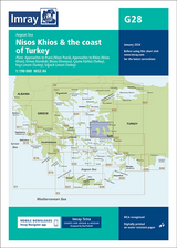
Imray Chart G28
Imray, Laurie, Norie & Wilson Ltd (Verlag)
978-1-78679-015-6 (ISBN)
Approaches to Psara (Nisos Psara) (1:15,000)
Approaches to Khios (Nisos Khios) (1:20,000)
Ormos Mandraki (Nisos Oinoussa) (1:8,000)
Cesme Koerfezi (Turkey) (1:18,000)
Foca Limani (Turkey) (1:20,000)
Sigacik Limani (Turkey) (1:18,000)
On this 2018 edition full details of the new TSS schemes are shown at Izmir Koerfezi, Candarli Koerfezi and Nemrut Koyu; revised depths and harbour developments are shown at Psara, Khios, Cesme and Foca; the Sigacik Limani sketch plan has been replaced with a fully WGS84-compatible version; the latest known depths, restricted areas and marine farms have been applied to the main chart; and details of the recently deployed AIS transmitters are shown across the chart.
Imray Laurie Norie & Wilson Ltd was formed in 1904 when three private chart publishing firms amalgamated. Each of these London companies had a long history going back to the mid-18th century. James Imray and Son published an extensive list of charts and pilot books. RH Laurie and Sons was associated with charts published for the East India Company. Norie and Wilson, founded by JW Norie, whose Nautical Tables are still supplied to navigators across the world, produced charts and books on navigation and sold nautical instruments.Until 1939 we were based in the City of London, where long serving cartographers produced charts from copper plate engravings which were supplied to mariners throughout the World. For over a century Blueback Charts were the first choice of many shipping companies. Now based in St Ives in Cambridgeshire, Imray charts are produced digitally for printed and electronic editions by our drawing office team. Our catalogue of yachting charts is regarded by the sailing community as the most comprehensive available. Our paper charts are complemented by a growing list of electronic publications and high quality pilot books by leading authors.
| Erscheint lt. Verlag | 1.5.2018 |
|---|---|
| Reihe/Serie | G Series ; 28 |
| Verlagsort | Huntingdon |
| Sprache | englisch |
| Maße | 210 x 295 mm |
| Gewicht | 140 g |
| Themenwelt | Sachbuch/Ratgeber ► Sport ► Segeln / Tauchen / Wassersport |
| Reisen ► Karten / Stadtpläne / Atlanten ► Europa | |
| Reisen ► Sport- / Aktivreisen ► Europa | |
| Technik ► Fahrzeugbau / Schiffbau | |
| Technik ► Maschinenbau | |
| ISBN-10 | 1-78679-015-7 / 1786790157 |
| ISBN-13 | 978-1-78679-015-6 / 9781786790156 |
| Zustand | Neuware |
| Informationen gemäß Produktsicherheitsverordnung (GPSR) | |
| Haben Sie eine Frage zum Produkt? |
aus dem Bereich


