


Scotland Pocket Map
2014
|
New edition
Collins (Verlag)
978-0-00-754131-7 (ISBN)
Collins (Verlag)
978-0-00-754131-7 (ISBN)
- Titel erscheint in neuer Auflage
- Artikel merken
Zu diesem Artikel existiert eine Nachauflage
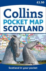
Handy little full colour map of Scotland. Excellent value and very detailed for its size. Double-sided folded map with the Central Belt, southern Scotland and northern England on one side and northern Scotland including Orkney and Shetland on the reverse.
FEATURES:
• Clear mapping at a scale of 8.7 miles to 1 inch.
• National Tourist Routes showing best routes through the most scenic areas.
• Top 100 places of interest.
• Park and Ride locations.
• Ideal companion to a sat-nav – it enables route planning and route sense-checking.
Essential for those planning a trip or who want an inexpensive and easy-to-use back up for a sat-nav.
Explore the world through accurate and up-to-date mapping.
| Erscheint lt. Verlag | 13.3.2014 |
|---|---|
| Zusatzinfo | Index |
| Verlagsort | London |
| Sprache | englisch |
| Maße | 90 x 140 mm |
| Gewicht | 40 g |
| Themenwelt | Reisen ► Karten / Stadtpläne / Atlanten ► Europa |
| ISBN-10 | 0-00-754131-7 / 0007541317 |
| ISBN-13 | 978-0-00-754131-7 / 9780007541317 |
| Zustand | Neuware |
| Informationen gemäß Produktsicherheitsverordnung (GPSR) | |
| Haben Sie eine Frage zum Produkt? |
Mehr entdecken
aus dem Bereich


aus dem Bereich
Karte (gefalzt) (2024)
Freytag-Berndt und ARTARIA (Verlag)
CHF 18,95
Georgien, Armenien, Aserbaidschan
Karte (gefalzt) (2025)
Freytag-Berndt und ARTARIA (Verlag)
CHF 24,90