


Philip's Multiscale Europe
Seiten
2001
|
Revised edition
Philip's (Verlag)
978-0-540-07944-5 (ISBN)
Philip's (Verlag)
978-0-540-07944-5 (ISBN)
- Titel erscheint in neuer Auflage
- Artikel merken
Zu diesem Artikel existiert eine Nachauflage
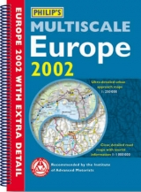
This map of Europe uses four different scales of mapping, covering the the Orkneys to Istanbul and from Gibraltar to St Petersburg, along with detailed tourist information. There are also 24 pages of travel information, including driving regulations. Scale covers four miles to one inch.
A map of Europe. It uses four different scales of mapping, covering the whole of Europe, from the Orkneys to Istanbul and from Gibraltar to St Petersburg, along with detailed tourist information. There are 24 pages of travel information, including driving regulations, a guide to the great sites of Europe, a business guide to industrial centres and driving information for ski resorts. There are 16 pages of route planning maps covering the whole of Europe at the scale of 64 miles to one inch. These are designed to enable journeys of up to 700 miles to be planned and followed without turning the page. Then 80 pages of digitally-produced road maps are featured, at the scale of 16 miles to one inch. These include new scenic driving routes and enhanced tourist information such as towns, beaches, ferries, national parks, historic sites and other tourist attractions. Next, there are 23 large-scale approach maps for major cities and urban areas. These show the routes of entry to each city through busy and complex urban road systems. There are 41 detailed city centre plans.These show historic buildings and tourist attractions, car parks, post offices, police stations and railway and underground stations.
All main streets are clearly marked and named. For ease of use the city plan is shown adjacent to the relevant urban approach map. Among other features the atlas also includes a 50-city distances table (in miles and kilometres).
| Erscheint lt. Verlag | 5.1.2001 |
|---|---|
| Zusatzinfo | index |
| Verlagsort | London |
| Sprache | englisch |
| Maße | 212 x 297 mm |
| Gewicht | 590 g |
| Themenwelt | Reisen ► Karten / Stadtpläne / Atlanten ► Europa |
| ISBN-10 | 0-540-07944-8 / 0540079448 |
| ISBN-13 | 978-0-540-07944-5 / 9780540079445 |
| Zustand | Neuware |
| Informationen gemäß Produktsicherheitsverordnung (GPSR) | |
| Haben Sie eine Frage zum Produkt? |
Mehr entdecken
aus dem Bereich


aus dem Bereich
Buch | Leporello (2025)
Kompass-Karten (Verlag)
CHF 21,90