Nancy Centenary Maps Karte (gefalzt) 2014 | Michelin Editions des Voyages ISBN: 9782067192225 CHF 17,65 (inkl. MwSt) Titel ist leider vergriffen; keine Neuauflage
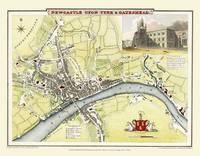
John Bartholomew's Map of Newcastle 1898 Colour Print of Map of Newcastle 1898 von John Bartholomew Karte (plano) 2010 | Mapseeker Archive Publishing ISBN: 9781844916528 CHF 22,65 (inkl. MwSt) Keine Verlagsinformationen verfügbar
John Bartholomew's Map of Scarborough 1898 Colour Print of Map of Scarborough 1898 von John Bartholomew Karte (plano) 2010 | Mapseeker Archive Publishing ISBN: 9781844916573 CHF 22,65 (inkl. MwSt) Keine Verlagsinformationen verfügbar
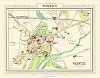
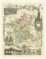
John Bartholomew's Map of Warwick 1898 Colour Print of Map of Warwick 1898 von John Bartholomew Karte (plano) 2010 | Mapseeker Archive Publishing ISBN: 9781844916535 CHF 22,65 (inkl. MwSt) Keine Verlagsinformationen verfügbar
John Tallis Map of East Canada 1851 Colour Print of Map of East Canada, East Brunswick 1851 by John Tallis von John Tallis Karte (plano) 2010 | Mapseeker Archive Publishing ISBN: 9781844913725 CHF 22,65 (inkl. MwSt) Keine Verlagsinformationen verfügbar
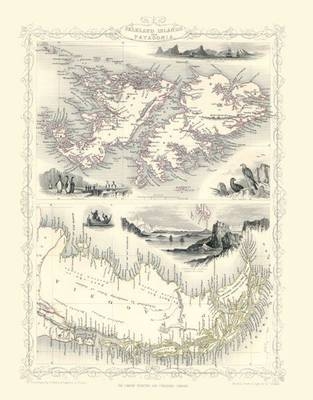
John Tallis Map of Falkland Islands 1851 Colour Print of Map of Falkland Islands or Patagonia 1851 by John Tallis von John Tallis Karte (plano) 2010 | Mapseeker Archive Publishing ISBN: 9781844913817 CHF 22,65 (inkl. MwSt) Keine Verlagsinformationen verfügbar
Thomas Moules Map of Middlesex 1837 Colour Print of County Map of Middlesex 1837 by Thomas Moule von Thomas Moule Karte (plano) 2010 | Mapseeker Archive Publishing ISBN: 9781844913473 CHF 22,65 (inkl. MwSt) Keine Verlagsinformationen verfügbar
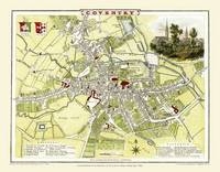
Cole and Roper Map of Coventry 1807 Colour Print of City of Coventry Plan 1807 by Cole and Roper von Cole and Roper Karte (plano) 2010 | Mapseeker Archive Publishing ISBN: 9781844912865 CHF 22,65 (inkl. MwSt) Keine Verlagsinformationen verfügbar
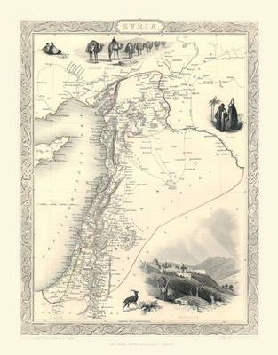
John Tallis Map of Syria 1851 Colour Print of Map of Syria 1851 by John Tallis von John Tallis Karte (plano) 2010 | Mapseeker Archive Publishing ISBN: 9781844914098 CHF 22,65 (inkl. MwSt) Keine Verlagsinformationen verfügbar
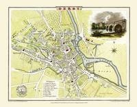
Cole and Roper Map of Derby 1806 Colour Print of Derby Town Plan 1806 by Cole and Roper von Cole and Roper Karte (plano) 2010 | Mapseeker Archive Publishing ISBN: 9781844912889 CHF 22,65 (inkl. MwSt) Keine Verlagsinformationen verfügbar
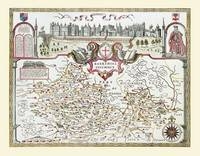
John Speeds Map of Berkshire 1611 Colour Print of County Map of Berkshire 1611 by John Speed von John Speed Karte (plano) 2010 | Historical Images Ltd ISBN: 9781844912216 CHF 26,15 (inkl. MwSt) Keine Verlagsinformationen verfügbar
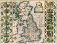
John Speeds Map of Saxon Britain Colour Print of Map of Saxon Britain by John Speed 1611 von John Speed Karte (plano) 2010 | Historical Images Ltd ISBN: 9781844912094 CHF 26,15 (inkl. MwSt) Keine Verlagsinformationen verfügbar
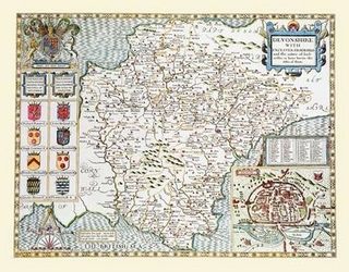
John Speeds Map of Devon 1611 Colour Print of County Map of Devon 1611 by John Speed von John Speed Karte (plano) 2010 | Historical Images Ltd ISBN: 9781844912445 CHF 26,15 (inkl. MwSt) Keine Verlagsinformationen verfügbar
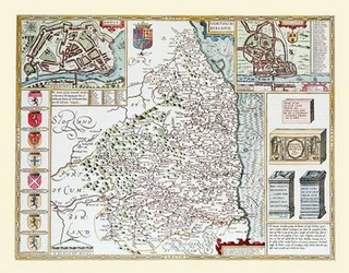
John Speeds Map of Northumberland 1611 Colour Print of County Map of Northumberland 1611 by John Speed von John Speed Karte (plano) 2010 | Historical Images Ltd ISBN: 9781844912544 CHF 26,15 (inkl. MwSt) Keine Verlagsinformationen verfügbar
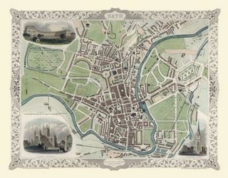
John Tallis Map of Bath 1851 Colour Print of City of Bath Plan 1851 by John Tallis von John Speed Karte (plano) 2010 | Mapseeker Archive Publishing ISBN: 9781844912605 CHF 22,65 (inkl. MwSt) Keine Verlagsinformationen verfügbar
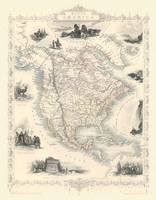
John Tallis Map of North America 1851 Colour Print of Map of North America 1851 by John Tallis von John Tallis Karte (plano) 2010 | Mapseeker Archive Publishing ISBN: 9781844913114 CHF 22,65 (inkl. MwSt) Keine Verlagsinformationen verfügbar
John Tallis Map of Tasmania 1851 Colour Print of Van Diemens Land or Tasmania 1851 by John Tallis von John Tallis Karte (plano) 2010 | Mapseeker Archive Publishing ISBN: 9781844914111 CHF 22,65 (inkl. MwSt) Keine Verlagsinformationen verfügbar
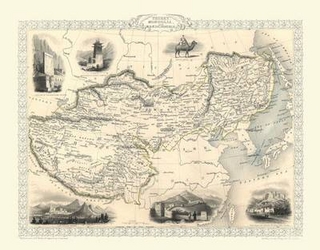
John Tallis Map of Tibet 1851 Colour Print of Map of Tibet, Mongolia and Mandchouria 1851 by John Tallis von John Tallis Karte (plano) 2010 | Mapseeker Archive Publishing ISBN: 9781844914128 CHF 26,15 (inkl. MwSt) Keine Verlagsinformationen verfügbar
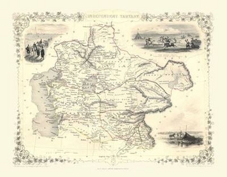
John Tallis Map of Independent Tartary 1851 Colour Print Map of Independent Tartary 1851 by John Tallis von John Tallis Karte (plano) 2010 | Mapseeker Archive Publishing ISBN: 9781844914104 CHF 22,65 (inkl. MwSt) Keine Verlagsinformationen verfügbar
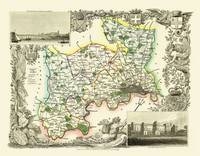
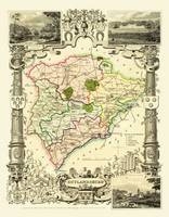
Thomas Moules Map of Rutlandshire 1837 Colour Prin of County Map of Rutlandshire 1837 by Thomas Moule von Thomas Moule Karte (plano) 2010 | Mapseeker Archive Publishing ISBN: 9781844913541 CHF 22,65 (inkl. MwSt) Keine Verlagsinformationen verfügbar
Cole and Roper Map of Newcastle 1808 Colour Print of Newcastle Town Plan 1808 by Cole and Roper von Cole and Roper Karte (plano) 2010 | Mapseeker Archive Publishing ISBN: 9781844912902 CHF 22,65 (inkl. MwSt) Keine Verlagsinformationen verfügbar
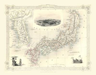
John Tallis Map of Japan and Korea 1851 Colour Print of Map of Japan and Korea 1851 by John Tallis von John Tallis Karte (plano) 2010 | Mapseeker Archive Publishing ISBN: 9781844913879 CHF 22,65 (inkl. MwSt) Keine Verlagsinformationen verfügbar
John Tallis Map of Brazil 1851 Colour Print of Map of Brazil 1851 by John Tallis von John Tallis Karte (plano) 2010 | Mapseeker Archive Publishing ISBN: 9781844913701 CHF 22,65 (inkl. MwSt) Keine Verlagsinformationen verfügbar
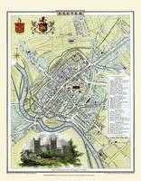
Cole and Roper Map of Exeter 1805 Colour Print of City of Exeter Plan 1805 by Cole and Roper von Cole and Roper Karte (plano) 2010 | Mapseeker Archive Publishing ISBN: 9781844912971 CHF 22,65 (inkl. MwSt) Keine Verlagsinformationen verfügbar
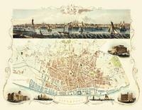
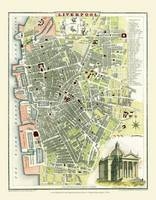
John Tallis Map of Liverpool 1851 Colour Print of Liverpool Town Plan1851 by John Tallis von John Tallis Karte (plano) 2010 | Mapseeker Archive Publishing ISBN: 9781844912711 CHF 22,65 (inkl. MwSt) Keine Verlagsinformationen verfügbar
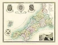
Thomas Moules Map of Cornwall 1837 Colour Print of County Map of Cornwall 1837 by Thomas Moule von Thomas Moule Karte (plano) 2010 | Mapseeker Archive Publishing ISBN: 9781844913282 CHF 22,65 (inkl. MwSt) Keine Verlagsinformationen verfügbar
Thomas Moules Map of London 1837 Colour Print of Map of London 1837 by Thomas Moule von Thomas Moule Karte (plano) 2010 | Mapseeker Archive Publishing ISBN: 9781844913336 CHF 22,65 (inkl. MwSt) Keine Verlagsinformationen verfügbar
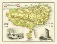
Thomas Moules Map of Isle of Thanet 1837 Colour Print of Map of Isle of Thanet 1837 by Thomas Moule von Thomas Moule Karte (plano) 2010 | Mapseeker Archive Publishing ISBN: 9781844913428 CHF 22,65 (inkl. MwSt) Keine Verlagsinformationen verfügbar
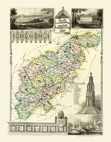
Thomas Moules Map of Northamptonshire 1837 Colour Print of County Map of Northamptonshire 1837 by Thomas Moule von Thomas Moule Karte (plano) 2010 | Mapseeker Archive Publishing ISBN: 9781844913503 CHF 22,65 (inkl. MwSt) Keine Verlagsinformationen verfügbar
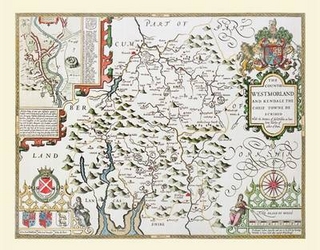
Thomas Moules Map of Westmoreland 1837 Colour Print of County Map of Westmoreland 1837 by Thomas Moule von Thomas Moule Karte (plano) 2010 | Mapseeker Archive Publishing ISBN: 9781844913602 CHF 22,65 (inkl. MwSt) Keine Verlagsinformationen verfügbar
Thomas Moules Map of Wiltshire 1837 Colour Print of County Map of Wiltshire 1837 by Thomas Moule von Thomas Moule Karte (plano) 2010 | Mapseeker Archive Publishing ISBN: 9781844913619 CHF 22,65 (inkl. MwSt) Keine Verlagsinformationen verfügbar
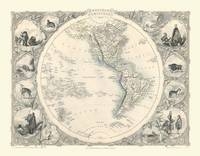
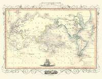
John Tallis Map of Western Hemisphere 1851 Colour Print of Map of Western Hemisphere 1851 by John Tallis von John Tallis Karte (plano) 2010 | Mapseeker Archive Publishing ISBN: 9781844914203 CHF 22,65 (inkl. MwSt) Keine Verlagsinformationen verfügbar
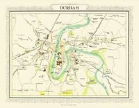
John Bartholomew's Map of Durham 1898 Colour Print of Map of Durham 1898 von John Bartholomew Karte (plano) 2010 | Mapseeker Archive Publishing ISBN: 9781844916474 CHF 22,65 (inkl. MwSt) Keine Verlagsinformationen verfügbar
John Bartholomews Map of Eastbourne 1898 Colour Print of Map of Eastbourne 1898 von John Bartholomew Karte (plano) 2010 | Mapseeker Archive Publishing ISBN: 9781844916481 CHF 22,65 (inkl. MwSt) Keine Verlagsinformationen verfügbar
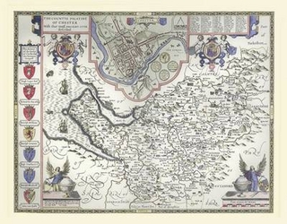
John Speeds Map of Cheshire 1611 Colour Print of County Map of Cheshire 1611 by John Speed von John Speed Karte (plano) 2010 | Historical Images Ltd ISBN: 9781844912414 CHF 26,15 (inkl. MwSt) Keine Verlagsinformationen verfügbar
Cole and Roper Map of Liverpool 1807 Colour Print of Liverpool Town Plan 1807 by Cole and Roper von Cole and Roper Karte (plano) 2010 | Mapseeker Archive Publishing ISBN: 9781844912827 CHF 22,65 (inkl. MwSt) Keine Verlagsinformationen verfügbar
John Speeds Map of Westmoreland 1611 Colour Print of County Map of Westmoreland 1611 by John Speed von John Speed Karte (plano) 2010 | Historical Images Ltd ISBN: 9781844912391 CHF 26,15 (inkl. MwSt) Keine Verlagsinformationen verfügbar
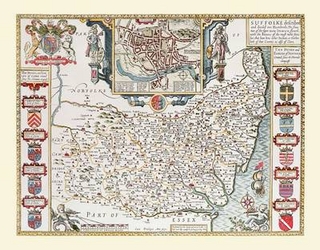
John Speeds Map of Suffolk 1611 Colour Print of County Map of Suffolk 1611 by John Speed von John Speed Karte (plano) 2010 | Historical Images Ltd ISBN: 9781844912551 CHF 26,15 (inkl. MwSt) Keine Verlagsinformationen verfügbar
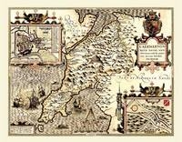
John Speed's Map of Caernarfon 1611 Colour Print of County Map of Caernarfon 1611 von John Speed Karte (plano) 2010 | Mapseeker Archive Publishing ISBN: 9781844916641 CHF 26,15 (inkl. MwSt) Keine Verlagsinformationen verfügbar
John Speeds Map of Buckinghamshire 1611 Colour Print of County Map of Buckinghamshire 1611 by John Speed von John Speed Karte (plano) 2010 | Historical Images Ltd ISBN: 9781844912223 CHF 26,15 (inkl. MwSt) Keine Verlagsinformationen verfügbar
John Tallis Map of Greece 1851 Colour Print of Map of Greece 1851 by John Tallis von John Tallis Karte (plano) 2010 | Mapseeker Archive Publishing ISBN: 9781844913831 CHF 22,65 (inkl. MwSt) Keine Verlagsinformationen verfügbar
Thomas Moules Map of Buckinghamshire 1837 Colour Print of County Map of Buckinghamshire 1837 by Thomas Moule von Thomas Moule Karte (plano) 2010 | Mapseeker Archive Publishing ISBN: 9781844913244 CHF 22,65 (inkl. MwSt) Keine Verlagsinformationen verfügbar
Thomas Moules Map of Gloucestershire 1837 Colour Print of County Map of Gloucestershire 1837 by Thomas Moule von Thomas Moule Karte (plano) 2010 | Mapseeker Archive Publishing ISBN: 9781844913367 CHF 22,65 (inkl. MwSt) Keine Verlagsinformationen verfügbar
Thomas Moules Map of Worcestershire 1837 Colour Print of County Map of Worcestershire 1837 by Thomas Moule von Thomas Moule Karte (plano) 2010 | Mapseeker Archive Publishing ISBN: 9781844913626 CHF 22,65 (inkl. MwSt) Keine Verlagsinformationen verfügbar
John Tallis Map of Captain Cooks Voyages Produced in 1851 Colour Print of Map of Captain Cooks Voyages Produced in 1851 by John Tallis von John Tallis Karte (plano) 2010 | Mapseeker Archive Publishing ISBN: 9781844914173 CHF 22,65 (inkl. MwSt) Keine Verlagsinformationen verfügbar
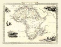
John Tallis Map of Africa 1851 Colour Print of Map of Africa 1851 by John Tallis von John Tallis Karte (plano) 2010 | Mapseeker Archive Publishing ISBN: 9781844913091 CHF 22,65 (inkl. MwSt) Keine Verlagsinformationen verfügbar
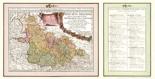
Historische Karte: Nieder-Schlesien, 1725/1745 (Plano) Ducatus Silesiae Tabula Geographica Prima INFERIOREM EIUS PARTEM seu NOVEM PRINCIPATUS, quorum insignia hic adjecta sunt, sucundum statum.. von Erben Homann Karte (gerollt) 2009 | Auflage: 1 | Verlag Rockstuhl ISBN: 9783867771405 CHF 29,15 (inkl. MwSt) Keine Verlagsinformationen verfügbar
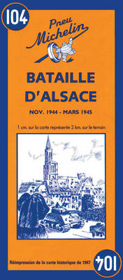
Battle of Alsace - Michelin Historical Map 104 Map Karte/Kartografie 1997 | Michelin Editions des Voyages ISBN: 9782067002647 CHF 14,40 (inkl. MwSt) Keine Verlagsinformationen verfügbar
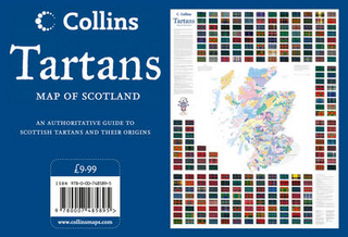
Tartans Wall Map of Scotland von Collins Maps Karte (gerollt) 2012 | Collins ISBN: 9780007485895 CHF 17,40 (inkl. MwSt) Titel ist leider vergriffen; keine Neuauflage
Strasbourg - Mulhouse Centenary Maps Karte (gefalzt) 2014 | Michelin Editions des Voyages ISBN: 9782067192317 CHF 17,65 (inkl. MwSt) Titel ist leider vergriffen; keine Neuauflage