Zum Hauptinhalt springen
Nicht aus der Schweiz? Besuchen Sie lehmanns.de

Ergebnisse zu
Hilfswissenschaften

Fachgebiete anzeigen
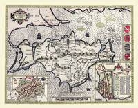
Large Poster Sized Photographic Quality Print of Map of the Isle of Wight 1611
von John Speed
Karte (gerollt)
2010 | Historical Images Ltd
ISBN: 9781844916757
CHF 52,35 (inkl. MwSt)
  • Keine Verlagsinformationen verfü
    gbar
20" x 16" Photographic Print of the Isle of Wight
von John Speed
Karte (plano)
2010 | Historical Images Ltd
ISBN: 9781844916603
CHF 38,40 (inkl. MwSt)
  • Keine Verlagsinformationen verfü
    gbar
Colour Photographic Print of Map of Austria 1852
von H. Collins
Karte (plano)
2010 | Mapseeker Archive Publishing
ISBN: 9781844916801
CHF 34,90 (inkl. MwSt)
  • Keine Verlagsinformationen verfü
    gbar
Colour Print of Map of Durham 1898
von John Bartholomew
Karte (plano)
2010 | Mapseeker Archive Publishing
ISBN: 9781844916474
CHF 22,65 (inkl. MwSt)
  • Keine Verlagsinformationen verfü
    gbar
Photographic Print of Map of Switzerland 1851 by John Tallis
von John Tallis
Karte (plano)
2010 | Mapseeker Archive Publishing
ISBN: 9781844911967
CHF 34,90 (inkl. MwSt)
  • Keine Verlagsinformationen verfü
    gbar
Photographic Print of Tazmania 1851 by John Tallis
von John Tallis
Karte (plano)
2010 | Mapseeker Archive Publishing
ISBN: 9781844911998
CHF 34,90 (inkl. MwSt)
  • Keine Verlagsinformationen verfü
    gbar
Photodraphic Print of Map of the Western Hemisphere 1851 by John Tallis
von John Tallis
Karte (plano)
2010 | Mapseeker Archive Publishing
ISBN: 9781844912087
CHF 38,40 (inkl. MwSt)
  • Keine Verlagsinformationen verfü
    gbar
20" x 16" Photographic Print of the Isle of Man
von Thomas Moule
Karte (plano)
2010 | Mapseeker Archive Publishing
ISBN: 9781844911264
CHF 38,40 (inkl. MwSt)
  • Keine Verlagsinformationen verfü
    gbar
Photographic Print of Map of Africa 1852
von H. Collins
Karte (plano)
2010 | Mapseeker Archive Publishing
ISBN: 9781844916771
CHF 38,40 (inkl. MwSt)
  • Keine Verlagsinformationen verfü
    gbar
Colour Print of Map of Newcastle 1898
von John Bartholomew
Karte (plano)
2010 | Mapseeker Archive Publishing
ISBN: 9781844916528
CHF 22,65 (inkl. MwSt)
  • Keine Verlagsinformationen verfü
    gbar
Photographic Print of Map of Plymouth and Devonport 1898
von John Bartholomew
Karte (plano)
2010 | Mapseeker Archive Publishing
ISBN: 9781844916252
CHF 38,40 (inkl. MwSt)
  • Keine Verlagsinformationen verfü
    gbar
Theatrum Belli Rhenani Feligibus Auspicilis Strenuissimi ac Illustrissimi Danielis Wolfii van Dopfe. Ar te aigimont et Nederkan. Ducis Generalis..
von Peter (der Ältere) Schenk
Karte (plano)
2005 | Auflage: 1 | Verlag Rockstuhl
ISBN: 9783937135939
CHF 29,15 (inkl. MwSt)
  • Keine Verlagsinformationen verfü
    gbar
Karte (gefalzt)
1998 | Collins
ISBN: 9780004486864
CHF 13,85 (inkl. MwSt)
  • Titel ist leider vergriffen;
    keine Neuauflage
Wall Maps Continents
von National Geographic Maps
Karte/Kartografie
2012 | National Geographic Maps
ISBN: 9781597752770
CHF 45,85 (inkl. MwSt)
  • Titel nicht im Sortiment
20" x 16" Photographic Print of the County of Staffordshire - England
von Historical Images Ltd
Karte/Kartografie
2010 | Historical Images Ltd
ISBN: 9781844910083
CHF 38,40 (inkl. MwSt)
  • Keine Verlagsinformationen verfü
    gbar
Wall Maps Continents
von National Geographic Maps
Karte (gerollt)
2012 | National Geographic Maps
ISBN: 9781597752589
CHF 31,90 (inkl. MwSt)
  • Titel nicht im Sortiment