Vosges / Alsace-Lorraine road map Karte (gefalzt) 2022 | ANWB BV, Netherlands ISBN: 9789018048389 CHF 22,65 (inkl. MwSt) Versand in 10-14 Tagen
Languedoc-Roussillon, Ardèche / Cevenn. / Pyr. East road map Karte (gefalzt) 2022 | ANWB BV, Netherlands ISBN: 9789018048440 CHF 22,65 (inkl. MwSt) Versand in 10-14 Tagen
Brittany road map Karte (gefalzt) 2022 | ANWB BV, Netherlands ISBN: 9789018048365 CHF 22,65 (inkl. MwSt) Versand in 10-14 Tagen
Champagne / Île de France road map Karte (gefalzt) 2022 | ANWB BV, Netherlands ISBN: 9789018048372 CHF 22,65 (inkl. MwSt) Versand in 10-14 Tagen
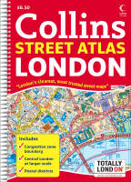
London Street Atlas Buch | Spiralbindung 2008 | Collins ISBN: 9780007257614 CHF 11,35 (inkl. MwSt) Titel erscheint in neuer Auflage
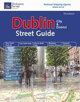
Dublin City and District Street Guide von Ordnance Survey Ireland Buch | Spiralbindung 2008 | Ordnance Survey Ireland ISBN: 9781905511648 CHF 18,90 (inkl. MwSt) Titel erscheint in neuer Auflage
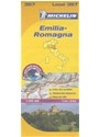
Emilia / Romagna Karte (gefalzt) 2017 | Michelin Editions des Voyages ISBN: 9782067127197 CHF 18,70 (inkl. MwSt) Versand in 10-14 Tagen
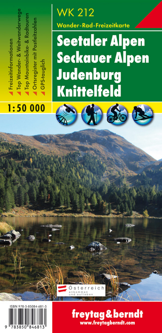
WK 212 Seetaler Alpen - Seckauer Alpen - Judenburg - Knittelfeld, Wanderkarte 1:50.000 von Freytag-Berndt und Artaria KG Karte (gefalzt) 2017 | Freytag-Berndt und ARTARIA ISBN: 9783850846813 CHF 21,90 (inkl. MwSt) Titel z.Zt. nicht lieferbar
283 Arolla Grand Combin - Lac des Dix - Matterhorn Karte (gefalzt) 2018 | swisstopo ISBN: 9783302002835 CHF 13,95 (inkl. MwSt) sofort lieferbar
Map of UK and Ireland Poster 2002 | Schofield & Sims Ltd ISBN: 9780721709383 CHF 43,95 (inkl. MwSt) Versand in 10-20 Tagen
Lesparre-Medoc / Mortagne-sur-Gironde Karte (gefalzt) 2017 | Institut Geographique National ISBN: 9782758539391 CHF 25,25 (inkl. MwSt) Versand in 3-4 Wochen
Aigues-Mortes / La Grande-Motte Karte (gefalzt) 2019 | Institut Geographique National ISBN: 9782758543190 CHF 29,95 (inkl. MwSt) Versand in 3-4 Wochen
Sète / Cap d'Agde / Etang de Thau Karte (gefalzt) 2019 | Institut Geographique National ISBN: 9782758543091 CHF 36,15 (inkl. MwSt) Versand in 3-4 Wochen
Le Teilleul / Landivy Karte (gefalzt) 2019 | Institut Geographique National ISBN: 9782758545989 CHF 25,25 (inkl. MwSt) Versand in 3-4 Wochen
Lac d'Issarlès / Thueyts / Sources de la Loire Karte (gefalzt) 2019 | Institut Geographique National ISBN: 9782758543152 CHF 28,60 (inkl. MwSt) Versand in 3-4 Wochen
Haut Cians / Valberg / PN du Mercantour Karte (gefalzt) 2019 | Institut Geographique National ISBN: 9782758543350 CHF 25,25 (inkl. MwSt) Versand in 3-4 Wochen
Nègrepelisse / Monclar-de-Quercy Karte (gefalzt) 2019 | Institut Geographique National ISBN: 9782758546160 CHF 25,25 (inkl. MwSt) Versand in 3-4 Wochen
Mont Aigoual / Le Vigan / PNR des Cévennes Karte (gefalzt) 2019 | Institut Geographique National ISBN: 9782758546542 CHF 36,15 (inkl. MwSt) Versand in 3-4 Wochen
La Roche-sur-Yon / Bournezeau Karte (gefalzt) 2019 | Institut Geographique National ISBN: 9782758545965 CHF 25,25 (inkl. MwSt) Versand in 3-4 Wochen
Portsmouth A-Z Street Map Karte (plano) 2017 | Geographers' A-Z Map Co Ltd ISBN: 9781782572022 CHF 42,75 (inkl. MwSt) Versand in 15-20 Tagen