


London Street Atlas
Seiten
2008
|
New edition
Collins (Verlag)
978-0-00-725761-4 (ISBN)
Collins (Verlag)
978-0-00-725761-4 (ISBN)
- Titel erscheint in neuer Auflage
- Artikel merken
Zu diesem Artikel existiert eine Nachauflage
Scale: 1:20,000 (3.17 inches to 1 mile), Central area 1:10,000 (6.3 inches to 1 mile).
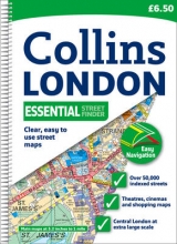
This handy little atlas features high quality Collins mapping. A huge amount of detail is contained within the mapping without compromising the clarity. Central London is mapped at a larger scale.
MAIN FEATURES
• Extremely clear, attractive, full colour street map with enlarged central area.
• Full index to places, street names and places of interest.
• Theatres and cinemas map, plus shopping map.
• Popular spiral binding.
INCLUDES
• Colour coded primary routes and public buildings.
• Street markets and pedestrian streets.
• Borough boundaries plus postal district boundaries and codes.
AREA OF COVERAGE
Extends from Epping Forest in the north to Chessington in the south and from Heathrow in the west to Bexley in the east.
WHO THE PRODUCT IS OF INTEREST TO
This atlas, with its huge amount of detail and the clarity of the maps is an essential purchase for all residents and businesses in and around London.
| Erscheint lt. Verlag | 4.8.2008 |
|---|---|
| Zusatzinfo | Index |
| Verlagsort | London |
| Sprache | englisch |
| Maße | 134 x 198 mm |
| Gewicht | 498 g |
| Themenwelt | Reisen ► Karten / Stadtpläne / Atlanten ► Europa |
| ISBN-10 | 0-00-725761-9 / 0007257619 |
| ISBN-13 | 978-0-00-725761-4 / 9780007257614 |
| Zustand | Neuware |
| Informationen gemäß Produktsicherheitsverordnung (GPSR) | |
| Haben Sie eine Frage zum Produkt? |
Mehr entdecken
aus dem Bereich


aus dem Bereich
Buch | Leporello (2025)
Kompass-Karten (Verlag)
CHF 21,90