


Castles Map of Scotland
2009
|
New edition
Collins (Verlag)
978-0-00-728951-6 (ISBN)
Collins (Verlag)
978-0-00-728951-6 (ISBN)
- Titel erscheint in neuer Auflage
- Artikel merken
Zu diesem Artikel existiert eine Nachauflage
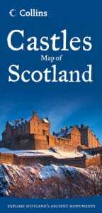
Pictorial map featuring over 800 castles and fortified houses complete with an easy-to-use index listing visitor information and attractive illustrations.
New for 2009: an additional category has been added comprising castellated mansions dating from 1650 onwards.
Index comprises map references, the age and type of each castle, public access details, Historic Scotland and National Trust for Scotland ownership, notable grounds and gardens, telephone numbers and websites.
Highlights Scotland’s finest castles, castellated mansions and also the best castles for children.
Attractive line drawings of a selection of the castles as they appeared at the end of the 19th century, together with a brief account of their history.
A brief history of Scottish castles and information on architectural types and periods of construction.
Internet links and suggested reading for further information.
Other titles in the series include:
Clans and Tartans Map of Scotland
Clan and Family Names Map of Scotland
Whisky Map of Scotland
Lake District Map
| Erscheint lt. Verlag | 2.4.2009 |
|---|---|
| Reihe/Serie | Pictorial Maps |
| Zusatzinfo | 50 b/w illus, Index |
| Verlagsort | London |
| Sprache | englisch |
| Maße | 124 x 257 mm |
| Gewicht | 100 g |
| Themenwelt | Reisen ► Karten / Stadtpläne / Atlanten ► Europa |
| Technik ► Architektur | |
| ISBN-10 | 0-00-728951-0 / 0007289510 |
| ISBN-13 | 978-0-00-728951-6 / 9780007289516 |
| Zustand | Neuware |
| Informationen gemäß Produktsicherheitsverordnung (GPSR) | |
| Haben Sie eine Frage zum Produkt? |
Mehr entdecken
aus dem Bereich


aus dem Bereich
Karte (gefalzt) (2024)
Freytag-Berndt und ARTARIA (Verlag)
CHF 18,95
Georgien, Armenien, Aserbaidschan
Karte (gefalzt) (2025)
Freytag-Berndt und ARTARIA (Verlag)
CHF 24,90