


Collins Primary World Atlas Whiteboard Edition
Seiten
2013
|
New edition
Collins (Hersteller)
978-0-00-748585-7 (ISBN)
Collins (Hersteller)
978-0-00-748585-7 (ISBN)
- Titel erscheint in neuer Auflage
- Artikel merken
Zu diesem Artikel existiert eine Nachauflage
Collins Whiteboard Atlases make geography lessons more interesting and get the whole-class to participate. The ’big book’ format enables you to work with all your students together, manipulating images and focusing on specific areas of study. The interactive format will help you and your pupils get the most from your atlas.
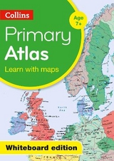
Collins Primary world Atlas presented on CD ROM for use on digital Whiteboards. 64 pages providing an introduction to mapping of the UK, Europe and major regions of the world.
Map skills section introduces map reading skills and a guide to using the atlas.
All reference maps are politically coloured clearly identifying country outlines. National flags of countries mapped on each spread are included.
Printable blank outline maps of the continents and the world are included to support classroom activities.
Key Features and Benefits of Collins Whiteboard Atlases:
Improves understanding of new concepts
Increases pupil motivation and involvement
Helps with the planning, pace and flow of lessons
Explore the world through accurate and up-to-date mapping.
| Erscheint lt. Verlag | 14.2.2013 |
|---|---|
| Reihe/Serie | Collins Primary Atlases |
| Verlagsort | London |
| Sprache | englisch |
| Maße | 135 x 192 mm |
| Gewicht | 80 g |
| Themenwelt | Schulbuch / Wörterbuch |
| ISBN-10 | 0-00-748585-9 / 0007485859 |
| ISBN-13 | 978-0-00-748585-7 / 9780007485857 |
| Zustand | Neuware |
| Informationen gemäß Produktsicherheitsverordnung (GPSR) | |
| Haben Sie eine Frage zum Produkt? |