


Britain
2000
|
Revised edition
Collins (Verlag)
978-0-00-448990-2 (ISBN)
Collins (Verlag)
978-0-00-448990-2 (ISBN)
- Titel erscheint in neuer Auflage
- Artikel merken
Zu diesem Artikel existiert eine Nachauflage
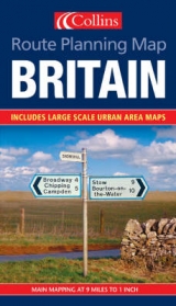
1:550,000 9 miles to 1 inch approx .Covers the whole of Britain on a double sided map with roads fully classified for ease of use. Ideal as a journey planning aid.
MAIN FEATURES
• Clear, attractive mapping at approximately 9 miles to 1 inch of the whole of Britain
• Urban area maps at 4 miles to 1 inch
• Restricted motorway junctions
INCLUDES
• Selection of important tourist sites
• Rail network shown
• Distances marked on roads
AREA OF COVERAGE
Covers the whole of Britain.
WHO THE PRODUCT IS OF INTEREST TO
Ideal purchase for both business user and tourist alike who want a clear route planning map of the whole of Britain.
| Erscheint lt. Verlag | 7.2.2000 |
|---|---|
| Reihe/Serie | Route Planning Map |
| Zusatzinfo | Col.M. |
| Verlagsort | London |
| Sprache | englisch |
| Maße | 140 x 245 mm |
| Gewicht | 110 g |
| Themenwelt | Reisen ► Karten / Stadtpläne / Atlanten ► Europa |
| Schulbuch / Wörterbuch ► Lexikon / Chroniken | |
| ISBN-10 | 0-00-448990-X / 000448990X |
| ISBN-13 | 978-0-00-448990-2 / 9780004489902 |
| Zustand | Neuware |
| Informationen gemäß Produktsicherheitsverordnung (GPSR) | |
| Haben Sie eine Frage zum Produkt? |
Mehr entdecken
aus dem Bereich


aus dem Bereich
Georgien, Armenien, Aserbaidschan
Karte (gefalzt) (2025)
Freytag-Berndt und ARTARIA (Verlag)
CHF 24,90
markierte Wanderwege, Hütten, Radrouten
Karte (gefalzt) (2023)
Kompass-Karten (Verlag)
CHF 26,90