


Collins Rail Map of Europe
Plan Your Flight-Free European Adventure
Seiten
2025
Collins (Verlag)
978-0-00-871104-7 (ISBN)
Collins (Verlag)
978-0-00-871104-7 (ISBN)
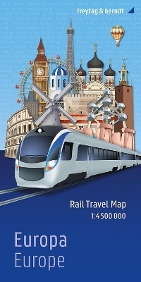
Looking for your next adventure? This rail map of Europe is the perfect planning and travel companion
Ever wanted to wake up in Paris, have lunch in Geneva and fall asleep in Rome? By using Europe's extensive train network, that dream can be a reality!
With a durable card-cover, clear mapping and essential travel information and inspiration, there's no better way to plan your plane-free journey around Europe. Showing all the essential railways across the continent, differentiating between high-speed and normal lines for ease of use, this two-sided map provides full coverage of mainland Europe and the United Kingdom.
Additional features include:
Suggested itineraries and routes as sources of inspiration
Information about each country accompanied by beautiful pictures
Tips for European travel, including information about ticket types and passes, currencies, train company websites, and safety information for travellers
A country-by-country station finder section to make searching easier
'Where to go and when' calendar to plan your travels around
A practical tool for use on-the-go, as well as a source of inspiration for planning your dream trip – this is the perfect gift for anyone setting off on a sustainable adventure around Europe.
Explore the world through accurate and up-to-date mapping.
| Erscheint lt. Verlag | 13.2.2025 |
|---|---|
| Verlagsort | London |
| Sprache | englisch |
| Maße | 1000 x 890 mm |
| Gewicht | 100 g |
| Themenwelt | Natur / Technik ► Fahrzeuge / Flugzeuge / Schiffe ► Schienenfahrzeuge |
| Reisen ► Karten / Stadtpläne / Atlanten ► Europa | |
| Reisen ► Reiseführer ► Europa | |
| ISBN-10 | 0-00-871104-6 / 0008711046 |
| ISBN-13 | 978-0-00-871104-7 / 9780008711047 |
| Zustand | Neuware |
| Informationen gemäß Produktsicherheitsverordnung (GPSR) | |
| Haben Sie eine Frage zum Produkt? |
Mehr entdecken
aus dem Bereich
aus dem Bereich
Karte (gefalzt) (2025)
Freytag-Berndt und ARTARIA (Verlag)
CHF 24,90