


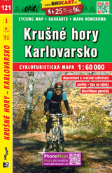
Krusné hory - Karlovarsko
Seiten
2019
Shocart (Verlag)
978-80-7224-525-3 (ISBN)
Shocart (Verlag)
978-80-7224-525-3 (ISBN)
- Titel z.Zt. nicht lieferbar
- Portofrei ab CHF 40
- Auch auf Rechnung
- Artikel merken
Map from very popular edition of cycling maps covering the territory of the entire Czech Republic. The map features indication of route distances and a navigability rating of all paths suitable for cycling. All content was verified directly in the field prior to publishing. The back page contains both a map key and recommended excursions. The map is enclosed in a clear plastic case.
| Erscheint lt. Verlag | 31.7.2020 |
|---|---|
| Reihe/Serie | SHOCart Radkarte 1:60.000 Tschechien ; 121 |
| Sprache | englisch |
| Maße | 110 x 170 mm |
| Gewicht | 58 g |
| Themenwelt | Sachbuch/Ratgeber ► Sport ► Motor- / Rad- / Flugsport |
| Reisen ► Karten / Stadtpläne / Atlanten ► Europa | |
| Schlagworte | Erzgebirge • Karlovy Vary • Karlsbad • Krušné hory • radfahren • Radkarte • SHOCart • Tschechien • Wanderkarte • Wandern |
| ISBN-10 | 80-7224-525-2 / 8072245252 |
| ISBN-13 | 978-80-7224-525-3 / 9788072245253 |
| Zustand | Neuware |
| Informationen gemäß Produktsicherheitsverordnung (GPSR) | |
| Haben Sie eine Frage zum Produkt? |
Mehr entdecken
aus dem Bereich


![Uckermark, 1:75.000 [offizielle Karte des ADFC, Allgemeiner Deutscher Fahrrad-Club] - ADFC - Allgemeiner Deutscher Fahrrad-Club e.V.](/media/107442469)
aus dem Bereich
Colmar, Mülhausen
Karte (gefalzt) (2025)
Kompass-Karten (Verlag)
CHF 31,90
Karte (gefalzt) (2023)
BVA BikeMedia (Verlag)
CHF 17,90