


Offa's Dyke Path
Seiten
2020
Harvey Map Services Ltd (Verlag)
978-1-85137-619-3 (ISBN)
Harvey Map Services Ltd (Verlag)
978-1-85137-619-3 (ISBN)
- Titel nicht im Sortiment
- Artikel merken
Offa's Dyke Path Entire route on one mapOffa's Dyke Path is a National Trail 285km long (177 miles) along the border between Wales and England. The route runs from Chepstow in the south to Prestatyn on the north Wales coast.Offa was a famous king of Mercia from 757 to 796, ruling an area stretching across a large part of England.Offa's Dyke Path runs from sea to sea - the Severn Estuary to Liverpool Bay. For about 112km (70 miles) the Path follows the course of what was originally an 8m ditch and rampart. Castles, forts and historic sites dot the route.Tough, light, durable and 100% waterproof
| Erscheint lt. Verlag | 30.1.2020 |
|---|---|
| Reihe/Serie | Trail Map XT40 |
| Verlagsort | Perthshire |
| Sprache | englisch |
| Maße | 115 x 245 mm |
| Gewicht | 52 g |
| Themenwelt | Sachbuch/Ratgeber ► Sport |
| Reisen ► Karten / Stadtpläne / Atlanten | |
| ISBN-10 | 1-85137-619-4 / 1851376194 |
| ISBN-13 | 978-1-85137-619-3 / 9781851376193 |
| Zustand | Neuware |
| Informationen gemäß Produktsicherheitsverordnung (GPSR) | |
| Haben Sie eine Frage zum Produkt? |
Mehr entdecken
aus dem Bereich
aus dem Bereich
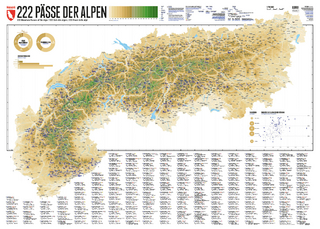
222 Mountain Passes of the Alps / 222 Cols des Alpes / 222 Passi …
Karte (gerollt) (2024)
Marmota Maps GmbH (Verlag)
CHF 84,90
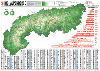
Und 20 besondere Wanderwege
Karte (gerollt) (2025)
Marmota Maps GmbH (Verlag)
CHF 84,90