


Arran Ultramap XT40
including Arran Coastal Way
Seiten
2016
Harvey Map Services Ltd (Verlag)
978-1-85137-588-2 (ISBN)
Harvey Map Services Ltd (Verlag)
978-1-85137-588-2 (ISBN)
- Titel nicht im Sortiment
- Artikel merken
Covers a large area yet is handily compact. Pocket perfect!Features the renowned Goat Fell, A'Chir ridge, Beinn Bharrain, Glen Sannox & Glen Rosa.Detailed map for runners and walkers of the whole island at the magic 1:40,000 scale.The 100km (62 miles) Arran Coastal Way is also shown. The route links the coastline of the island with the villages and the stunning scenery Arran has to offer.Includes Gaelic-English glossary and information on local archaeological and historical sites.
| Erscheint lt. Verlag | 16.6.2016 |
|---|---|
| Reihe/Serie | Ultramap XT40 |
| Verlagsort | Perthshire |
| Sprache | englisch |
| Maße | 73 x 152 mm |
| Themenwelt | Sachbuch/Ratgeber ► Sport |
| Reisen ► Karten / Stadtpläne / Atlanten ► Europa | |
| ISBN-10 | 1-85137-588-0 / 1851375880 |
| ISBN-13 | 978-1-85137-588-2 / 9781851375882 |
| Zustand | Neuware |
| Informationen gemäß Produktsicherheitsverordnung (GPSR) | |
| Haben Sie eine Frage zum Produkt? |
Mehr entdecken
aus dem Bereich


aus dem Bereich
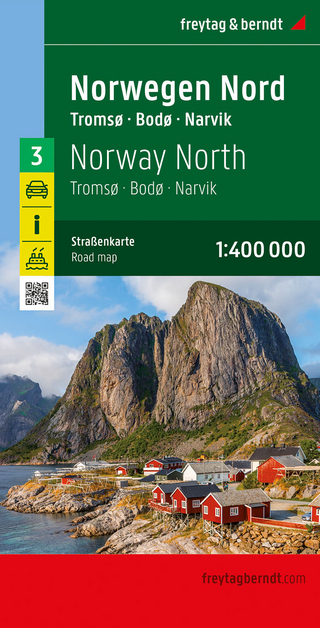
Narvik
Karte (gefalzt) (2023)
Freytag-Berndt und ARTARIA (Verlag)
CHF 21,90
Karte (gefalzt) (2024)
Freytag-Berndt und ARTARIA (Verlag)
CHF 18,95
Karte (gefalzt) (2025)
Kompass-Karten (Verlag)
CHF 31,90