


London Big Ben Map
2009
|
New edition
Collins (Verlag)
978-0-00-727384-3 (ISBN)
Collins (Verlag)
978-0-00-727384-3 (ISBN)
- Titel erscheint in neuer Auflage
- Artikel merken
Zu diesem Artikel existiert eine Nachauflage
Scale: 1:9,000 (7 inches to 1 mile).
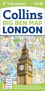
This colourful fold out map is ideal for visitors and tourists to central London. The map includes: shopping areas, theatres, cinemas, hotels, places of tourist interest and bus routes. The key to map symbols is in English, French, Spanish, German and Japanese.
MAIN FEATURES
This colourful little map is an ideal day trip or tourist purchase. It is packed with useful information including major shops, museums, theatres, selected pubs and popular restaurant areas. Footpaths and pedestrian areas are shown for those exploring the city by foot. Planning journeys by public transport is made easy with numbered bus routes and underground stations colour coded on the map face to identify the relevant tube line. The key to map symbols is shown in English, French, German, Spanish and Japanese and the index includes street names, places of interest, major hotels, cinemas, hospitals, tourist information centres and much more.
INCLUDES
• Clear easy-to-read street map packed with information.
• Places of tourist interest plotted and colour coded.
• Handy small format and durable card cover.
AREA OF COVERAGE
From King’s Cross in the north to Pimlico in the south and from South Kensington in the west to the Tower of London in the east.
WHO THIS TITLE IS OF INTEREST TO
This product is especially useful to the tourist or day tripper who wants to make the most of their visit to central London.
| Erscheint lt. Verlag | 5.3.2009 |
|---|---|
| Zusatzinfo | Index |
| Verlagsort | London |
| Sprache | englisch |
| Maße | 101 x 198 mm |
| Gewicht | 58 g |
| Themenwelt | Reisen ► Karten / Stadtpläne / Atlanten ► Europa |
| ISBN-10 | 0-00-727384-3 / 0007273843 |
| ISBN-13 | 978-0-00-727384-3 / 9780007273843 |
| Zustand | Neuware |
| Informationen gemäß Produktsicherheitsverordnung (GPSR) | |
| Haben Sie eine Frage zum Produkt? |
Mehr entdecken
aus dem Bereich


aus dem Bereich
Georgien, Armenien, Aserbaidschan
Karte (gefalzt) (2025)
Freytag-Berndt und ARTARIA (Verlag)
CHF 24,90
markierte Wanderwege, Hütten, Radrouten
Karte (gefalzt) (2023)
Kompass-Karten (Verlag)
CHF 26,90
Karte (gefalzt) (2025)
Kompass-Karten (Verlag)
CHF 31,90