


2009 Collins Handy Road Atlas Britain
Seiten
2008
|
New A5 edition
Collins (Verlag)
978-0-00-727239-6 (ISBN)
Collins (Verlag)
978-0-00-727239-6 (ISBN)
- Titel erscheint in neuer Auflage
- Artikel merken
Zu diesem Artikel existiert eine Nachauflage
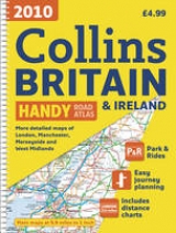
This handy A5 sized road atlas makes it the ideal travelling companion. It has extremely clear, route planning maps of Britain and Ireland and fits neatly into the glovebox, pocket or bag.
This clear, easy-to-use handy sized atlas has been fully updated for 2009. The maps of Britain are at 9.9 miles to 1 inch (1:625,000) and the whole of Ireland is covered at 15.8 miles to 1 inch (1:1,000,000). There are also a selection of more detailed urban area maps at 4.5 miles to 1 inch (1:285,000) to aid route planning in these busy areas.
The atlas includes:
• Road maps, greatly improved for 2009, that focus on the main roads, motorways and settlements.
• Useful distance calculator chart highlighting distances between the major towns.
• The Ireland section includes a separate distance chart and an index.
Ideal general purpose route planner in a handy lightweight format. It fits easily into the glovebox, briefcase, handbag or pocket.
| Erscheint lt. Verlag | 7.7.2008 |
|---|---|
| Zusatzinfo | Index |
| Verlagsort | London |
| Sprache | englisch |
| Maße | 154 x 210 mm |
| Gewicht | 136 g |
| Themenwelt | Reisen ► Karten / Stadtpläne / Atlanten ► Europa |
| ISBN-10 | 0-00-727239-1 / 0007272391 |
| ISBN-13 | 978-0-00-727239-6 / 9780007272396 |
| Zustand | Neuware |
| Informationen gemäß Produktsicherheitsverordnung (GPSR) | |
| Haben Sie eine Frage zum Produkt? |
Mehr entdecken
aus dem Bereich


aus dem Bereich
Buch | Leporello (2025)
Kompass-Karten (Verlag)
CHF 21,90