


John Muir Way (route map)
a Scottish coast-to-coast route
Seiten
2025
|
revised in 2025
Rucksack Readers (Verlag)
978-1-913817-30-5 (ISBN)
Rucksack Readers (Verlag)
978-1-913817-30-5 (ISBN)
The John Muir Way is a coast-to-coast route for cyclists and walkers that crosses Scotland from Helensburgh on the Clyde to Dunbar on the Forth (134 miles). This lightweight folded sheet map (scale 1:75,000) is designed for cyclists and walker. This second edition was updated and improved in 2025.
The John Muir Way is a coast-to-coast route for cyclists and walkers that crosses Scotland from Helensburgh on the Clyde to Dunbar on the Forth (134 miles/215 km). This lightweight folded sheet map (scale 1:75,000) is designed for cyclists and walkers and was created in partnership with NatureScot. Mapping was revised for this second edition in 2025 to include mileage markers, with more legibile labels and minor route updates. There is an 84-page guidebook with the same title, also from Rucksack Readers.
The John Muir Way is a coast-to-coast route for cyclists and walkers that crosses Scotland from Helensburgh on the Clyde to Dunbar on the Forth (134 miles/215 km). This lightweight folded sheet map (scale 1:75,000) is designed for cyclists and walkers and was created in partnership with NatureScot. Mapping was revised for this second edition in 2025 to include mileage markers, with more legibile labels and minor route updates. There is an 84-page guidebook with the same title, also from Rucksack Readers.
After a long career in education, information technology and academic publishing, Jacquetta became interested in long-distance walking and trekking. After completing the West Highland Way, her first long walk, in 1998 she progressed to Mount Kilimanjaro, which she has since summited four times by different routes. She is a member of the Outdoor Writers and Photographers Guild and in 2016 won its Award for Excellence (jointly with Max Landsberg) for their jointly authored guidebook Trek to Everest. She coauthored the first guidebook to the John Muir Way and developed its folded sheet map in partnership with NatureScot (then Scottish Natural Heritage).
| Erscheint lt. Verlag | 6.6.2025 |
|---|---|
| Verlagsort | Dunblane |
| Sprache | englisch |
| Maße | 145 x 220 mm |
| Gewicht | 53 g |
| Themenwelt | Sachbuch/Ratgeber ► Sport |
| Reiseführer ► Europa ► Großbritannien | |
| ISBN-10 | 1-913817-30-X / 191381730X |
| ISBN-13 | 978-1-913817-30-5 / 9781913817305 |
| Zustand | Neuware |
| Informationen gemäß Produktsicherheitsverordnung (GPSR) | |
| Haben Sie eine Frage zum Produkt? |
Mehr entdecken
aus dem Bereich

aus dem Bereich
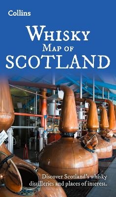
Discover Where Scotland’s National Drink is Produced
Karte (gefalzt) (2025)
Collins (Verlag)
CHF 21,90
Karte (gefalzt) (2025)
Lonely Planet Global Limited (Verlag)
CHF 16,90