Imray 2120 Chart Pack
Imray, Laurie, Norie & Wilson Ltd (Verlag)
978-1-78679-516-8 (ISBN)
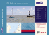
It covers the North Sea coast from the Belgian-French border, through the Zeeland, South Holland and North Holland coasts up to and including Den Helder. Available
New: Vessel Traffic Services (VTS) reporting points
Imray charts for this coast now include all VTS reporting points found in these waters. VTS reporting is mandatory for vessels of more than 20m in length.
1. North Sea Coast – Nieuwpoort to Hoek Van Holland (1:300 000)
2. North Sea Coast – Hoek van Holland to Texel (1:300 000)
3. Approaches to Nieuwpoort and Oostende (1:100 000) includes plans Niewpoort (1:30 000) and Oostende (1:20 000)
4. Oostende to Westkapelle (1:100 000) includes plans Blankenberge (1:15 000) and Zeebrugge (1:35 000)
5. Entrance to the Westerschelde (1:50 000) includes plans Breskens (1:15 000), Vlissingen (1:20 000) and Cadzand-Bad (1:10 000)
6. Westkapelle to Westhoofd (1:100 000) includes plan Roompotsluis (1:30 000)
7. West Schouwen to Hoek van Holland (1:100 000) includes plan Stellendam (1:30 000)
8. Hoek van Holland to IJmuiden (1:125 000) includes plans Scheveningen (1:15 000) and IJmuiden (1:35 000)
9. IJmuiden to Den Helder (1:125 000)
10. Approaches to Den Helder (1:50 000) includes plan Den Helder (1:20 000)
11. Southern North Sea passage planning chart (1:500 000)
This edition includes the latest depth surveys and windfarm details along with routes across the North Sea. There has been general updating throughout.
Commended for the John C Bartholemew Award for Thematic Mapping at the 2016 British Cartographic Society Awards.
Imray Laurie Norie & Wilson Ltd was formed in 1904 when three private chart publishing firms amalgamated. Each of these London companies had a long history going back to the mid-18th century. James Imray and Son published an extensive list of charts and pilot books. RH Laurie and Sons was associated with charts published for the East India Company. Norie and Wilson, founded by JW Norie, whose Nautical Tables are still supplied to navigators across the world, produced charts and books on navigation and sold nautical instruments.Until 1939 we were based in the City of London, where long serving cartographers produced charts from copper plate engravings which were supplied to mariners throughout the World. For over a century Blueback Charts were the first choice of many shipping companies. Now based in St Ives in Cambridgeshire, Imray charts are produced digitally for printed and electronic editions by our drawing office team. Our catalogue of yachting charts is regarded by the sailing community as the most comprehensive available. Our paper charts are complemented by a growing list of electronic publications and high quality pilot books by leading authors.
| Erscheinungsdatum | 15.05.2025 |
|---|---|
| Reihe/Serie | 2000 Series ; 2120 |
| Verlagsort | Huntingdon |
| Sprache | englisch |
| Themenwelt | Sachbuch/Ratgeber ► Sport ► Segeln / Tauchen / Wassersport |
| Reisen ► Karten / Stadtpläne / Atlanten | |
| Reisen ► Sport- / Aktivreisen ► Europa | |
| Technik ► Fahrzeugbau / Schiffbau | |
| ISBN-10 | 1-78679-516-7 / 1786795167 |
| ISBN-13 | 978-1-78679-516-8 / 9781786795168 |
| Zustand | Neuware |
| Informationen gemäß Produktsicherheitsverordnung (GPSR) | |
| Haben Sie eine Frage zum Produkt? |
aus dem Bereich