


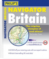
Philip's Navigator Britain
Seiten
2007
Philip's (Verlag)
978-0-540-09063-1 (ISBN)
Philip's (Verlag)
978-0-540-09063-1 (ISBN)
- Titel erscheint in neuer Auflage
- Artikel merken
Zu diesem Artikel existiert eine Nachauflage
Shows speed-camera locations, with their speed limits, and provides over 3,000 road names as well as numbers in Britain. This title also includes a selection of 72 indexed town-centre maps, airport and port maps, detailed approach maps, London main roads maps, detailed route-planning maps, and a distance table.
"Philip's Navigator[registered] Britain" shows speed-camera locations, with their speed limits, and provides over 3,000 road names as well as numbers. It also includes a massive selection of 72 indexed town-centre maps, plus airport and port maps, detailed approach maps, London main roads maps, detailed route-planning maps, a distance table, and a 43,000-name index which includes places of interest. The main road maps are at the scale of 1.5 miles to 1 inch (Northern Scotland at 3 miles to 1 inch) and are extra clear and detailed, showing even the smallest roads and lanes that are omitted from other atlases.Every roundabout, junction and slip-road is shown in detail on main roads and motorways. In country areas, thousands of individual houses and farms are marked, along with footpaths and tracks. The alpha-numeric grid is based on the National Grid, so that the atlas can be used with GPS systems, and the grid squares have been made smaller for this edition, making it easier to find locations when using the index.
Thousands of tourist attractions and places of interest are shown on the maps, including national parks, nature reserves, houses and gardens, beaches, marinas, canals, county showgrounds, camping and caravan sites, shopping villages, tramways, World Heritage Sites, long-distance footpaths, sporting venues, park and rides, and ferries. "Philip's Navigator[registered] Britain" is widely used by professional drivers and the emergency services, including national police training, and is recommended in the motoring press and national newspapers.
| Erscheint lt. Verlag | 28.2.2007 |
|---|---|
| Reihe/Serie | Road Atlases |
| Zusatzinfo | all col. maps |
| Verlagsort | London |
| Sprache | englisch |
| Maße | 298 x 350 mm |
| Gewicht | 2075 g |
| Themenwelt | Reisen ► Karten / Stadtpläne / Atlanten ► Europa |
| ISBN-10 | 0-540-09063-8 / 0540090638 |
| ISBN-13 | 978-0-540-09063-1 / 9780540090631 |
| Zustand | Neuware |
| Informationen gemäß Produktsicherheitsverordnung (GPSR) | |
| Haben Sie eine Frage zum Produkt? |
Mehr entdecken
aus dem Bereich


aus dem Bereich
Buch | Leporello (2025)
Kompass-Karten (Verlag)
CHF 21,90