


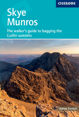
Skye Munros
The walker's guide to bagging the Cuillin summits
Seiten
2026
Cicerone Press (Verlag)
978-1-78631-204-4 (ISBN)
Cicerone Press (Verlag)
978-1-78631-204-4 (ISBN)
- Noch nicht erschienen (ca. Januar 2026)
- Portofrei ab CHF 40
- Auch auf Rechnung
- Artikel merken
This 2-volume set provides all the information required to complete the Skye Munros. Strategy, gear, training, navigation and logistics are covered. A lightweight second guidebook gives the hiker detailed maps, topos and route description for the Cuillin Munros and Tops.
A definitive 2-volume guidebook to the 12 Munros of the Cuillin on the Isle of Skye – the most technically demanding Munros in Scotland, rising in a jagged 3000ft skyline straight from the sea. More than simple hillwalking, these summits demand Grade 3 scrambling, rock climbing to Moderate and abseiling, technical skill, a head for heights, and confidence on steep and exposed rocky ground. This set is written for experienced mountain walkers, Munroists and seasoned scramblers looking to complete the Cuillin ridge peaks safely and efficiently.
Volume 1 covers planning and logistics, seasonal and weather considerations (with a focus on the summer “window” from May to September), recommended kit for technical ground and the best bases in Glen Brittle and Sligachan. It also introduces the history and character of each of the 12 summits. Volume 2 provides five carefully structured routes – a 5-day itinerary that can also be broken down into bite-sized chunks of a single peak or two per day – with step-by-step route description, Harvey mapping and detailed photo topos to support safe navigation on complex terrain. The two volumes are sold together.
Step-by-step, way-numbered route descriptions with Harvey mapping and photo topos
Covers all 12 Cuillin Munros, including the Inaccessible Pinnacle
Includes Munro Top routes and the easiest ascent options for tackling summits individually
Practical planning guidance: bases, camping, approach routes and seasonal advice
Volume 2 is perfectly sized to carry with you during the hikes
Adrian Trendall is a mountain guide and photographer living on Skye. He has been climbing since the 1980s with a CV that includes Alpine north faces, big walls in Yosemite and first ascents on the White Cliffs of Dover. Adrian lives at the foot of the Cuillin running a guiding and photography company, All Things Cuillin, and has set up the very popular Facebook group of the same name.
| Erscheint lt. Verlag | 31.1.2026 |
|---|---|
| Reihe/Serie | Cicerone guidebooks |
| Zusatzinfo | 30 maps, 33 topos and 60 photos |
| Verlagsort | Kendal |
| Sprache | englisch |
| Maße | 116 x 172 mm |
| Themenwelt | Sachbuch/Ratgeber ► Sport |
| Reiseführer ► Europa ► Großbritannien | |
| Reisen ► Sport- / Aktivreisen ► Europa | |
| ISBN-10 | 1-78631-204-2 / 1786312042 |
| ISBN-13 | 978-1-78631-204-4 / 9781786312044 |
| Zustand | Neuware |
| Informationen gemäß Produktsicherheitsverordnung (GPSR) | |
| Haben Sie eine Frage zum Produkt? |
Mehr entdecken
aus dem Bereich

aus dem Bereich