


Discovering London
The Illustrated Map
2007
|
New edition
Collins (Verlag)
978-0-00-723294-9 (ISBN)
Collins (Verlag)
978-0-00-723294-9 (ISBN)
- Titel erscheint in neuer Auflage
- Artikel merken
Zu diesem Artikel existiert eine Nachauflage
Scale: 1:8,250 (7.5 inches to 1 mile).
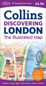
London has a vast array of museums, galleries and other attractions.
This hand-watercoloured map contains individual paintings of all the main sites and landmarks, shop-by-shop street maps, theatres and cinemas, comprehensive travel information and index.
This attractive, fact-filled map includes:
Railway stations, bus routes, London underground map, taxi ranks and car parks.
Shop-by-shop street maps for Oxford Street, Bond Street, Covent Garden, Portobello Road, King’s Road, Brompton Cross, Exmouth Market, Beauchamp Place, St. Christopher’s Place and South Molton Street, Knightsbridge, Jermyn Street and Kensington.
London’s theatres and cinemas.
Places to eat, internet cafés and good places for a picnic.
An inset map of the City of London.
Comprehensive index.
Historical and contemporary anecdotes.
OTHER TITLES IN THE SERIES
Discovering Edinburgh
Discovering Dublin
| Erscheint lt. Verlag | 5.3.2007 |
|---|---|
| Zusatzinfo | Index |
| Verlagsort | London |
| Sprache | englisch |
| Maße | 113 x 205 mm |
| Gewicht | 64 g |
| Themenwelt | Reisen ► Karten / Stadtpläne / Atlanten ► Europa |
| ISBN-10 | 0-00-723294-2 / 0007232942 |
| ISBN-13 | 978-0-00-723294-9 / 9780007232949 |
| Zustand | Neuware |
| Informationen gemäß Produktsicherheitsverordnung (GPSR) | |
| Haben Sie eine Frage zum Produkt? |
Mehr entdecken
aus dem Bereich


aus dem Bereich
Karte (gefalzt) (2024)
Freytag-Berndt und ARTARIA (Verlag)
CHF 18,95
markierte Wanderwege, Hütten, Radrouten
Karte (gefalzt) (2023)
Kompass-Karten (Verlag)
CHF 26,90
Karte (gefalzt) (2025)
Kompass-Karten (Verlag)
CHF 31,90