


Germany and Netherlands Road Map
Seiten
2006
Philip's OS Publications (Verlag)
978-0-540-08975-8 (ISBN)
Philip's OS Publications (Verlag)
978-0-540-08975-8 (ISBN)
- Titel erscheint in neuer Auflage
- Artikel merken
Zu diesem Artikel existiert eine Nachauflage
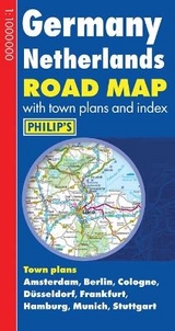
A brand new edition of Philip's sheet map covering the whole of Germany and the Netherlands.
Germany and the Netherlands are shown on two sides of the sheet, along with a comprehensive index and town plans. The map has been specifically prepared for long-distance travel, picking out major routes and destinations in bold colours for easy journey planning and route-finding, and includes town plans and a comprehensive index. The map is a convenient size for using in the vehicle.
The digital mapping gives excellent clarity at 16 miles to one inch (1cm = 10km), showing the road network in exceptional detail. Town plans are provided for Amsterdam, Berlin, Dusseldorf, Frankfurt, Hamburg, Cologne, Munich and Stuttgart. High quality travel information includes a wealth of useful detail marking car ferries, national parks, ski resorts, beaches, cathedrals, castles, ancient monuments and many other places of interest.
Main map scale: 16 miles to 1 inch
| Erscheint lt. Verlag | 28.7.2006 |
|---|---|
| Verlagsort | London |
| Sprache | englisch |
| Maße | 132 x 252 mm |
| Gewicht | 110 g |
| Themenwelt | Reisen ► Karten / Stadtpläne / Atlanten ► Deutschland |
| Reisen ► Karten / Stadtpläne / Atlanten ► Europa | |
| ISBN-10 | 0-540-08975-3 / 0540089753 |
| ISBN-13 | 978-0-540-08975-8 / 9780540089758 |
| Zustand | Neuware |
| Informationen gemäß Produktsicherheitsverordnung (GPSR) | |
| Haben Sie eine Frage zum Produkt? |
Mehr entdecken
aus dem Bereich


aus dem Bereich
Buch | Spiralbindung (2025)
MAIRDUMONT (Verlag)
CHF 23,90
Straßenatlas und Autoatlas mit Spiralbindung
Buch | Spiralbindung (2024)
MAIRDUMONT (Verlag)
CHF 43,90