


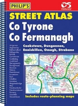
Philip's Street Atlas Co. Tyrone and Co. Fermanagh
Seiten
2006
Philip's (Verlag)
978-0-540-08933-8 (ISBN)
Philip's (Verlag)
978-0-540-08933-8 (ISBN)
- Titel erscheint in neuer Auflage
- Artikel merken
Zu diesem Artikel existiert eine Nachauflage
A brand new street atlas, and the only detailed colour atlas to give comprehensive coverage of the whole of Co.
A brand new street atlas, and the only detailed colour atlas that gives comprehensive coverage of the Tyrone & Fermanagh. No other atlas shows every street in Tyrone & Fermanagh.This atlas is part of a series of four atlases providing unique, comprehensive coverage of the whole of Northern Ireland.The mapping is based on Ordnance Survey Northern Ireland data and gives the user complete coverage of all urban and rural areas. The mapping is at a scale of 134 inches to 1 mile (1 1/3 inches to 1 mile in the pocket edition) with larger scale mapping of 3 1/2 inches to 1 mile (2 2/3 inches to 1 mile in the pocket edition) for the towns of Cookstown, Dungannon, Enniskillen, Omagh and Strabane,. The mapping also includes the townland names in rural areas with postcode boundaries shown throughout.The atlas is ideally suited for both business and leisure use. There is a route-planning map at the front of the atlas. The main maps show every named road, street and lane clearly with through-routes highlighted. School locations are marked and emergency services, hospitals, police stations, car parks and rail and bus station locations are all featured. There are separate comprehensive indexes of street names - with highlighted schools, industrial estates, hospitals, and sports centres - towns and villages and townlands.Main map scale: 1.75 inches to 1 mile and 3.5 inches to 1 mile
A brand new street atlas, and the only detailed colour atlas that gives comprehensive coverage of the Tyrone & Fermanagh. No other atlas shows every street in Tyrone & Fermanagh.This atlas is part of a series of four atlases providing unique, comprehensive coverage of the whole of Northern Ireland.The mapping is based on Ordnance Survey Northern Ireland data and gives the user complete coverage of all urban and rural areas. The mapping is at a scale of 134 inches to 1 mile (1 1/3 inches to 1 mile in the pocket edition) with larger scale mapping of 3 1/2 inches to 1 mile (2 2/3 inches to 1 mile in the pocket edition) for the towns of Cookstown, Dungannon, Enniskillen, Omagh and Strabane,. The mapping also includes the townland names in rural areas with postcode boundaries shown throughout.The atlas is ideally suited for both business and leisure use. There is a route-planning map at the front of the atlas. The main maps show every named road, street and lane clearly with through-routes highlighted. School locations are marked and emergency services, hospitals, police stations, car parks and rail and bus station locations are all featured. There are separate comprehensive indexes of street names - with highlighted schools, industrial estates, hospitals, and sports centres - towns and villages and townlands.Main map scale: 1.75 inches to 1 mile and 3.5 inches to 1 mile
| Erscheint lt. Verlag | 17.11.2006 |
|---|---|
| Verlagsort | London |
| Sprache | englisch |
| Maße | 190 x 269 mm |
| Gewicht | 359 g |
| Themenwelt | Reisen ► Karten / Stadtpläne / Atlanten ► Europa |
| ISBN-10 | 0-540-08933-8 / 0540089338 |
| ISBN-13 | 978-0-540-08933-8 / 9780540089338 |
| Zustand | Neuware |
| Informationen gemäß Produktsicherheitsverordnung (GPSR) | |
| Haben Sie eine Frage zum Produkt? |
Mehr entdecken
aus dem Bereich


aus dem Bereich
Buch | Leporello (2025)
Kompass-Karten (Verlag)
CHF 21,90