


World and United States Folded Reference Map Pack Bundle
With flags and facts
Seiten
2024
National Geographic Maps (Verlag)
978-1-56695-935-3 (ISBN)
National Geographic Maps (Verlag)
978-1-56695-935-3 (ISBN)
Waterproof Tear-Resistant Reference Map.
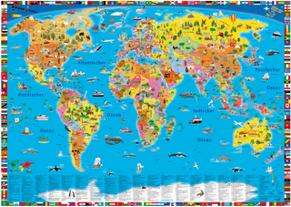
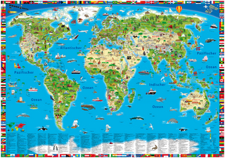
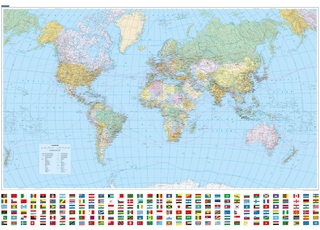
Expertly researched and designed, National Geographic's World and United States Flags and Facts Map is the authoritative map by which other reference maps are measured. The map side includeds a political map showing countries, cities and other landmarks and a physical map shows the landforms such as mountain ranges and rivers.
Clearly defined boundaries, major cities, and physical features
| Erscheint lt. Verlag | 15.8.2024 |
|---|---|
| Verlagsort | Evergreen |
| Sprache | englisch |
| Maße | 115 x 235 mm |
| Themenwelt | Reisen ► Karten / Stadtpläne / Atlanten ► Welt / Arktis / Antarktis |
| ISBN-10 | 1-56695-935-7 / 1566959357 |
| ISBN-13 | 978-1-56695-935-3 / 9781566959353 |
| Zustand | Neuware |
| Informationen gemäß Produktsicherheitsverordnung (GPSR) | |
| Haben Sie eine Frage zum Produkt? |
Mehr entdecken
aus dem Bereich
aus dem Bereich
Karte (gerollt) (2025)
Kümmerly+Frey (Verlag)
CHF 26,90