


AA Glovebox Atlas Britain with Town Plans
Seiten
2005
|
10th Revised edition
Automobile Association (Verlag)
978-0-7495-4586-4 (ISBN)
Automobile Association (Verlag)
978-0-7495-4586-4 (ISBN)
- Titel erscheint in neuer Auflage
- Artikel merken
Zu diesem Artikel existiert eine Nachauflage
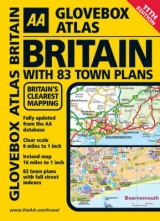
A new edition of this popular A5 sized road atlas at a clear 8 miles to 1 inch scale (Ireland at a 1:1 million scale), available in a spiral binding. Including information on road map symbols, key to map pages and mileage charts this is the perfect glovebox companion for travelling through Britain and Ireland. Including 83 city and town plans complete with street indexes, a comprehensive index of both Britain & Ireland with 4,500 place names and a county, administrative area map.
| Erscheint lt. Verlag | 31.10.2005 |
|---|---|
| Zusatzinfo | all col. maps |
| Verlagsort | Basingstoke |
| Sprache | englisch |
| Maße | 152 x 210 mm |
| Themenwelt | Reisen ► Karten / Stadtpläne / Atlanten ► Europa |
| ISBN-10 | 0-7495-4586-0 / 0749545860 |
| ISBN-13 | 978-0-7495-4586-4 / 9780749545864 |
| Zustand | Neuware |
| Informationen gemäß Produktsicherheitsverordnung (GPSR) | |
| Haben Sie eine Frage zum Produkt? |
Mehr entdecken
aus dem Bereich


aus dem Bereich
Buch | Leporello (2025)
Kompass-Karten (Verlag)
CHF 21,90