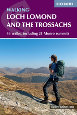
Walking Loch Lomond and the Trossachs
Cicerone Press (Verlag)
978-1-78631-240-2 (ISBN)
- Noch nicht erschienen (ca. Februar 2026)
- Portofrei ab CHF 40
- Auch auf Rechnung
- Artikel merken
A guidebook to 43 walks in Loch Lomond and the Trossachs National Park. From low-level short circuits to demanding mountain routes, there is something for walkers of all fitness levels and experience in this Scottish National Park.
The walks range in length from 3 to 26km (2–16 miles) and cover all 21 Munros in the region as well as a collection of its finest Corbetts and smaller hills.
1:50,000 OS maps included for each walk
GPX routes available to download
Highlights include ascents of Ben Lui and The Cobbler
Easy access from Edinburgh and Glasgow
Public transport and parking options given for each walk
Katie Featherstone is a freelance writer and the author of several guidebooks, writing predominantly about hiking, history and slow, sustainable travel. She spent the years 2017–2023 advising walkers as a mountain hut warden in the Icelandic Highlands before moving to Islay, off the west coast of Scotland. Loch Lomond and The Trossachs is her nearest national park and somewhere she tries to spend as much time as possible.
Map key Route summary table Introduction The national park History, archaeology and culture Geology Conservation, wildlife, plants and fungi Practicalities Getting there and around Camping and accommodation Shops, food and drink and other practicalities Walking When to go Walking conditions Gaining experience Safety and emergencies in the mountains Adders, ticks, midges and other biters Weather and snow Maps and navigation Using this guide THE EAST Part 1 The Trossachs Walk 1 Ben Venue Walk 2 Ben A’an Walk 3 Menteith Hills Walk 4 Doon Hill and Fairy Knowe Walk 5 Ben Ledi and Benvane Walk 6 Beinn a’Choin Part 2 Callander and Stathyre Walk 7 North Callander Circular Walk 8 Three Calander Bridges Walk 9 Beinn Each Walk 10 An Sìdhean Part 3 Lochearnhead and Inverlochlarig Walk 11 Stob a’Choin Walk 12 Beinn Tulaichean and Cruach Ardrain Walk 13 Stob Binnein and Ben More from the south Walk 14 From Lochearnhead around Edinchip Walk 15 Kendrum and Ogle Circle Walk 16 Meall an t-Seallaidh and Creag Mac Rànaich Walk 17 Ben Vorlich and Stùc a' Chroin THE NORTH Part 4 Killin and the far north-east Walk 18 Killin and Loch Tay Walk 19 Meall Glas and Sgiath Chùil (from Glen Lochay) Part 5 Tyndrum Walk 20 Glen Cononish Walk 21 Beinn Odhar Walk 22 Ben Lui via Dubhchraig and Oss Walk 23 Ben Lui via Chuirn and Dubh Walk 24 Beinn Challuim and Two Corbetts Part 6 Crianlarich to Inverarnan Walk 25 An Caisteal and Beinn a’ Chroin Horseshoe Walk 26 Beinn Chabhair LOCH LOMOND Part 7 Loch Lomond East Walk 27 Ben Lomond Walk 28 Ardess Hidden History Trail Walk 29 Conic Hill Walk 30 Inchcailloch and Balmaha Part 8 Luss Walk 31 Luss Hills: Beinn Dubh, Doune Hill and Beinn Eich THE WEST Part 9 Arrochar Alps Walk 32 Ben Vorlich and the Little Hills from Ardlui Walk 33 The Cobbler Walk 34 Straightforward Beinn Narnain and/or Beinn Ìme Walk 35 Arrochar to Ben Vane and Beinn Ìme Walk 36 Beinn Narnain and The Cobbler with optional extension to Beinn Ìme Walk 37 A’ Chrois, Beinn Narnain and The Cobbler Part 10 Glen Croe to Loch Goil Walk 38 The Brack and Ben Donich Walk 39 Argyll’s Bowling Green Walk 40 Beinn an Lochain Part 11 Cowal Walk 41 Loch Eck and Beinn Mhòr Walk 42 Puck’s Glen Walk 43 Kilmun to Strone Hill Appendix A Munros and Corbetts by route number Appendix B Access information Appendix C Gaelic in the landscape Appendix D The long routes Appendix E Further reading
| Erscheint lt. Verlag | 28.2.2026 |
|---|---|
| Reihe/Serie | Cicerone guidebooks |
| Zusatzinfo | 44 maps and 80 photos |
| Verlagsort | Kendal |
| Sprache | englisch |
| Maße | 116 x 172 mm |
| Gewicht | 340 g |
| Themenwelt | Sachbuch/Ratgeber ► Sport |
| Reiseführer ► Europa ► Großbritannien | |
| Reisen ► Sport- / Aktivreisen ► Europa | |
| ISBN-10 | 1-78631-240-9 / 1786312409 |
| ISBN-13 | 978-1-78631-240-2 / 9781786312402 |
| Zustand | Neuware |
| Informationen gemäß Produktsicherheitsverordnung (GPSR) | |
| Haben Sie eine Frage zum Produkt? |
aus dem Bereich