


Lake District Map
2005
|
New ed of Revised ed
Collins (Verlag)
978-0-00-718463-7 (ISBN)
Collins (Verlag)
978-0-00-718463-7 (ISBN)
- Titel erscheint in neuer Auflage
- Artikel merken
Zu diesem Artikel existiert eine Nachauflage
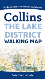
One of the titles in the relaunched "Collins Pictorial Maps series", this map of the Lake District features detailed full-colour mapping in the traditional Bartholomew style on one easy-to-use sheet.
Always popular with walkers and visitors to the Lake District. Features detailed layer-coloured mapping on one easy-to-use sheet. Scale 1 inch to 1 mile (1:63 360). / Layer tints, contour lines and spot heights to give an accurate indication of the rise and fall of the ground. / Roads, tracks, paths, youth hostels. / Lake District National Park Visitor and Information Centres. / Advice for walkers. / Internet links and other sources for further information.
Always popular with walkers and visitors to the Lake District. Features detailed layer-coloured mapping on one easy-to-use sheet. Scale 1 inch to 1 mile (1:63 360). / Layer tints, contour lines and spot heights to give an accurate indication of the rise and fall of the ground. / Roads, tracks, paths, youth hostels. / Lake District National Park Visitor and Information Centres. / Advice for walkers. / Internet links and other sources for further information.
| Erscheint lt. Verlag | 7.2.2005 |
|---|---|
| Reihe/Serie | Pictorial Maps |
| Verlagsort | London |
| Sprache | englisch |
| Maße | 122 x 215 mm |
| Gewicht | 86 g |
| Themenwelt | Reisen ► Karten / Stadtpläne / Atlanten ► Europa |
| ISBN-10 | 0-00-718463-8 / 0007184638 |
| ISBN-13 | 978-0-00-718463-7 / 9780007184637 |
| Zustand | Neuware |
| Informationen gemäß Produktsicherheitsverordnung (GPSR) | |
| Haben Sie eine Frage zum Produkt? |
Mehr entdecken
aus dem Bereich


aus dem Bereich
Karte (gefalzt) (2024)
Freytag-Berndt und ARTARIA (Verlag)
CHF 18,95