


Miniatlas London
Seiten
2004
Philip's OS Publications (Verlag)
978-0-540-08466-1 (ISBN)
Philip's OS Publications (Verlag)
978-0-540-08466-1 (ISBN)
- Titel erscheint in neuer Auflage
- Artikel merken
Zu diesem Artikel existiert eine Nachauflage
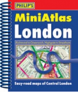
This atlas, in a mini format shows streets, courts, alleys, houses and estates of London and has a planning map of roads in and out of London. It shows one-way streets and restricted turns and features highlighted features such as hospitals. The index includes postcodes.
A fully revised edition of the "London Atlas" in a handy mini format, this title fits easily into a briefcase or handbag. It shows the centre of London with 96 pages at the ultra-large scale of 7 inches to one mile. The rest of London is shown on 76 pages at the clear scale of 3.5 inches to one mile. The atlas shows the locations of many thousands more named streets, courts, alleys, houses and estates. This, coupled with a detailed index, should have considerable benefits for professional users. Route-finding is much easier as through-routes are shown, giving the user the equivalent of local knowledge of an area, ideal for any driver and a real time-saver when avoiding main road queues. Furthermore, one-way streets and restricted turns are shown on the whole central London area. A planning map shows main roads in and out of London. Postcode districts and boundaries are shown on both the main mapping and on a separate map. The index of streets and notable features is fully comprehensive and has been carefully designed to be easy to use and read.Hospitals, railway stations, schools, shopping centres, universities, industrial estates and other such features are highlighted in red; places of tourist interest are shown in blue.
The index includes postcodes. There is a map for central London detailing over 50 theatres and cinemas and a special map shows the London Underground.
| Erscheint lt. Verlag | 2.2.2004 |
|---|---|
| Zusatzinfo | maps, indexes |
| Verlagsort | London |
| Sprache | englisch |
| Maße | 116 x 138 mm |
| Gewicht | 176 g |
| Themenwelt | Reisen ► Karten / Stadtpläne / Atlanten ► Europa |
| ISBN-10 | 0-540-08466-2 / 0540084662 |
| ISBN-13 | 978-0-540-08466-1 / 9780540084661 |
| Zustand | Neuware |
| Informationen gemäß Produktsicherheitsverordnung (GPSR) | |
| Haben Sie eine Frage zum Produkt? |
Mehr entdecken
aus dem Bereich


aus dem Bereich
Buch | Leporello (2025)
Kompass-Karten (Verlag)
CHF 21,90