


2021 Philip's Big Easy to Read Britain Road Atlas
(A3 Spiral binding)
Seiten
2020
Philip's (Verlag)
978-1-84907-534-3 (ISBN)
Philip's (Verlag)
978-1-84907-534-3 (ISBN)
- Titel erscheint in neuer Auflage
- Artikel merken
Zu diesem Artikel existiert eine Nachauflage
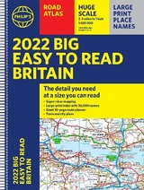
New to the Philip's range of road atlases. Super-clear, large-scale maps that everyone can read easily. A3, spiral bound edition that lies flat when opened.
"The detail you need at a size you can read"
The new 2021 Big Easy to Read Britain road atlas from Philip's
- Large print maps
- Huge 1:150,000 scale (approx 2.4 miles to 1 inch)
- Largeprint place names
- Large print index
- Large format (nearly A3)
- Super-clear 10-page routeplanner
- 88 large town plans
- 10 big city approach maps
- Easy to use spiral binding
At last, a Road Atlas that everyone can read easily in the car, no matter the conditions. Large scale maps. Large print place names. Clear road colours (which are easier to read in the dark). Large print index. And a special routeplanning section that's almost a road atlas in itself.
If it's dark - or simply if you can't find your glasses - the new Philip's Big Easy to Read Atlas of Britain is the answer - wherever you're driving in England, Scotland or Wales.
Philip's has been at the forefront of creating maps and atlases since 1834. Whether a local street map or a fact-packed World Atlas, we use the most up-to-date technology, expertise and our global network to ensure our customers have all the information they need.
| Erscheinungsdatum | 13.03.2020 |
|---|---|
| Reihe/Serie | Philip's Road Atlases |
| Verlagsort | London |
| Sprache | englisch |
| Maße | 392 x 294 mm |
| Gewicht | 1352 g |
| Themenwelt | Reisen ► Karten / Stadtpläne / Atlanten ► Europa |
| Naturwissenschaften ► Geowissenschaften ► Geografie / Kartografie | |
| ISBN-10 | 1-84907-534-4 / 1849075344 |
| ISBN-13 | 978-1-84907-534-3 / 9781849075343 |
| Zustand | Neuware |
| Informationen gemäß Produktsicherheitsverordnung (GPSR) | |
| Haben Sie eine Frage zum Produkt? |
Mehr entdecken
aus dem Bereich


aus dem Bereich
Buch | Leporello (2025)
Kompass-Karten (Verlag)
CHF 21,90