


Quercy Perigord - Zoom Map 118
Map
Seiten
2020
|
2018
Michelin Editions des Voyages (Verlag)
978-2-06-720986-2 (ISBN)
Michelin Editions des Voyages (Verlag)
978-2-06-720986-2 (ISBN)
Michelin's Zoom collection are characterized by the high precision of their detailed scale, specially adapted for very touristy areas or with a high density road network, including new developments and industrial areas. Scales from 1:53,000 to 1:1,267,200
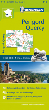
(Edition revised in 2018) MICHELIN zoom map Quercy Périgord is the ideal travel companion to fully explore this popular French destination, thanks to its easy-to-use format and its scale of 1/150,000.
The Zoom collection are characterized by the high precision of their detailed scale, specially adapted for very touristy areas or with a high density road network, including new developments and industrial areas. In addition to clarity, reliability and up-to-date information, all Michelin cartography features include a wealth of practical information: places and monuments of tourist interest, picturesque tours, areas for sports and leisure activities ... Useful plans of cities and a practical index of localities. Also the maps contain places of interest and signposting of tracks for bicycles and greenways.
MICHELIN ZOOM MAPS are perfect to discover major tourist areas, with a high level of details in an easy to use format.
They nicely complement our Michelin Guides and include:
* Various leisure activities, such as water parks, tourist trains, horse racing, etc
* Scenic routes and tourist sights crossed referenced with the famous Michelin's Green Guides
* Camping sites information from Michelin's Camping Guides
* Hotel information from the world famous MICHELIN Guides
| Erscheint lt. Verlag | 30.6.2020 |
|---|---|
| Reihe/Serie | MICHELIN Zoomkarten |
| Verlagsort | Paris |
| Sprache | englisch |
| Maße | 113 x 250 mm |
| Gewicht | 118 g |
| Themenwelt | Reisen ► Karten / Stadtpläne / Atlanten ► Europa |
| ISBN-10 | 2-06-720986-8 / 2067209868 |
| ISBN-13 | 978-2-06-720986-2 / 9782067209862 |
| Zustand | Neuware |
| Informationen gemäß Produktsicherheitsverordnung (GPSR) | |
| Haben Sie eine Frage zum Produkt? |
Mehr entdecken
aus dem Bereich


aus dem Bereich
Karte (gefalzt) (2024)
Freytag-Berndt und ARTARIA (Verlag)
CHF 18,95
Georgien, Armenien, Aserbaidschan
Karte (gefalzt) (2025)
Freytag-Berndt und ARTARIA (Verlag)
CHF 24,90
markierte Wanderwege, Hütten, Radrouten
Karte (gefalzt) (2023)
Kompass-Karten (Verlag)
CHF 26,90