


Road Atlas Ireland
Seiten
2003
|
New edition
Collins (Verlag)
978-0-00-715676-4 (ISBN)
Collins (Verlag)
978-0-00-715676-4 (ISBN)
- Titel erscheint in neuer Auflage
- Artikel merken
Zu diesem Artikel existiert eine Nachauflage
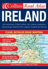
5.2 miles to 1 inch 1:350,000. A4 road atlas with large scale full colour mapping plus a section on places of interest complete with illustrations. Fully updated for 2003.
MAIN FEATURES
• Superb detailed and attractive mapping at 5.2 miles to 1 inch fully updated for 2003
• Attractive hill layer tints
• Full index to place names
• Tourist Information Centre listing
• Large scale town and city centre plans of Dublin, Belfast, Cork & Limerick
• Places of interest section with descriptions and illustrations
INCLUDES
• Route planning map of the whole of Ireland at 24 miles to 1 inch
• Travelling in Ireland information
• Information on Tourist Information Centres with address and telephone number referenced to the map
• Distance chart
• Radio station information
AREA OF COVERAGE
The mapping covers the whole of Ireland at 5.2 miles to 1 inch.
WHO THE PRODUCT IS OF INTEREST TO
The wealth of tourist information and extremely clear and attractive mapping make this an essential purchase for tourists.
| Erscheint lt. Verlag | 7.4.2003 |
|---|---|
| Zusatzinfo | Index |
| Verlagsort | London |
| Sprache | englisch |
| Maße | 210 x 297 mm |
| Gewicht | 195 g |
| Themenwelt | Reisen ► Karten / Stadtpläne / Atlanten ► Europa |
| ISBN-10 | 0-00-715676-6 / 0007156766 |
| ISBN-13 | 978-0-00-715676-4 / 9780007156764 |
| Zustand | Neuware |
| Informationen gemäß Produktsicherheitsverordnung (GPSR) | |
| Haben Sie eine Frage zum Produkt? |
Mehr entdecken
aus dem Bereich


aus dem Bereich
Buch | Leporello (2025)
Kompass-Karten (Verlag)
CHF 21,90