


Nicolson Road 2, West Scotland & The Western Isles
Seiten
2020
Nicolson Digital Ltd (Verlag)
978-1-912046-59-1 (ISBN)
Nicolson Digital Ltd (Verlag)
978-1-912046-59-1 (ISBN)
- Titel erscheint in neuer Auflage
- Artikel merken
Zu diesem Artikel existiert eine Nachauflage
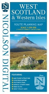
Updated version of our Road Map 2, 1/250000 scale route mapping based on Ordnance Survey data. Covering the Outer Hebrides and West coast of Scotland from Cape Wrath to Islay.
Featuring:
Clear road mapping & ferry routes
Index to place names
National & forest parks
Contours and peak heights
Featuring:
Clear road mapping & ferry routes
Index to place names
National & forest parks
Contours and peak heights
| Erscheint lt. Verlag | 30.9.2020 |
|---|---|
| Verlagsort | Largs |
| Sprache | englisch |
| Maße | 132 x 240 mm |
| Gewicht | 131 g |
| Themenwelt | Reisen ► Karten / Stadtpläne / Atlanten ► Europa |
| ISBN-10 | 1-912046-59-8 / 1912046598 |
| ISBN-13 | 978-1-912046-59-1 / 9781912046591 |
| Zustand | Neuware |
| Informationen gemäß Produktsicherheitsverordnung (GPSR) | |
| Haben Sie eine Frage zum Produkt? |
Mehr entdecken
aus dem Bereich


aus dem Bereich
Karte (gefalzt) (2024)
Freytag-Berndt und ARTARIA (Verlag)
CHF 18,95
Georgien, Armenien, Aserbaidschan
Karte (gefalzt) (2025)
Freytag-Berndt und ARTARIA (Verlag)
CHF 24,90
markierte Wanderwege, Hütten, Radrouten
Karte (gefalzt) (2023)
Kompass-Karten (Verlag)
CHF 26,90