


Driver's Atlas of Britain
Seiten
2002
|
Revised edition
Automobile Association (Verlag)
978-0-7495-3470-7 (ISBN)
Automobile Association (Verlag)
978-0-7495-3470-7 (ISBN)
- Titel erscheint in neuer Auflage
- Artikel merken
Zu diesem Artikel existiert eine Nachauflage
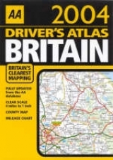
An atlas with 4 miles to 1 inch (1:250,000/2.5km to 1 cm) road mapping of Britain. Fully updated for 2003, this atlas features a combined route-planning map and page finder, an easy-to-use mileage chart, a full colour county and administrative map and an inset of all the major offshore islands.
A practical atlas with 4 miles to 1 inch (1:250,000/2.5km to 1 cm) road mapping of Britain. Fully updated for 2003, this atlas features a combined route-planning map and page finder, an easy-to-use mileage chart, a full colour county and administrative map and an index of more than 23,000 place names. Also included are insets of all the major offshore islands: Isles of Scilly; Western Isles; Orkney Isles; Shetland Isles; Channel Islands; and the Isle of Man.
A practical atlas with 4 miles to 1 inch (1:250,000/2.5km to 1 cm) road mapping of Britain. Fully updated for 2003, this atlas features a combined route-planning map and page finder, an easy-to-use mileage chart, a full colour county and administrative map and an index of more than 23,000 place names. Also included are insets of all the major offshore islands: Isles of Scilly; Western Isles; Orkney Isles; Shetland Isles; Channel Islands; and the Isle of Man.
| Erscheint lt. Verlag | 31.8.2002 |
|---|---|
| Reihe/Serie | AA Atlases S. |
| Zusatzinfo | index |
| Verlagsort | Basingstoke |
| Sprache | englisch |
| Maße | 210 x 297 mm |
| Gewicht | 510 g |
| Themenwelt | Reisen ► Karten / Stadtpläne / Atlanten ► Europa |
| ISBN-10 | 0-7495-3470-2 / 0749534702 |
| ISBN-13 | 978-0-7495-3470-7 / 9780749534707 |
| Zustand | Neuware |
| Informationen gemäß Produktsicherheitsverordnung (GPSR) | |
| Haben Sie eine Frage zum Produkt? |
Mehr entdecken
aus dem Bereich


aus dem Bereich
Buch | Leporello (2025)
Kompass-Karten (Verlag)
CHF 21,90