


Motorist's Atlas Britain
Seiten
2002
|
Revised edition
Automobile Association (Verlag)
978-0-7495-3420-2 (ISBN)
Automobile Association (Verlag)
978-0-7495-3420-2 (ISBN)
- Titel erscheint in neuer Auflage
- Artikel merken
Zu diesem Artikel existiert eine Nachauflage
This atlas includes route planning sections with district maps of Birmingham, Glasgow, Manchester, Tyne and Wear and London. The AA EuroRAP (European Road Assesment Programme) risk rating system for trunk roads and motorways, aims to make your journey more comfortable and secure.
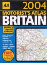
This atlas has been updated for 2003. The information includes journey and route planning sections. It also incorporates district maps of London, Birmingham, Glasgow, Manchester and Tyne and Wear, and M25 and M60 Manchester orbitol motorway maps. Central London is given a ten page indexed street map. Ireland is mapped as well, with a scale of 16 miles to one inch, and a seperate index for ease of use. The primary route destinations are highlighted which, combined with the AA EuroRAP (European Road Assesment Programme) risk rating system for trunk roads and motorways, aims to make your journey more comfortable and secure. The safest roads are highlighted in green, while the most dangerous are shown in black for easy guidance.
This atlas has been updated for 2003. The information includes journey and route planning sections. It also incorporates district maps of London, Birmingham, Glasgow, Manchester and Tyne and Wear, and M25 and M60 Manchester orbitol motorway maps. Central London is given a ten page indexed street map. Ireland is mapped as well, with a scale of 16 miles to one inch, and a seperate index for ease of use. The primary route destinations are highlighted which, combined with the AA EuroRAP (European Road Assesment Programme) risk rating system for trunk roads and motorways, aims to make your journey more comfortable and secure. The safest roads are highlighted in green, while the most dangerous are shown in black for easy guidance.
| Erscheint lt. Verlag | 1.7.2002 |
|---|---|
| Zusatzinfo | indexes |
| Verlagsort | Basingstoke |
| Sprache | englisch |
| Maße | 230 x 295 mm |
| Gewicht | 720 g |
| Themenwelt | Reisen ► Karten / Stadtpläne / Atlanten ► Europa |
| ISBN-10 | 0-7495-3420-6 / 0749534206 |
| ISBN-13 | 978-0-7495-3420-2 / 9780749534202 |
| Zustand | Neuware |
| Informationen gemäß Produktsicherheitsverordnung (GPSR) | |
| Haben Sie eine Frage zum Produkt? |
Mehr entdecken
aus dem Bereich


aus dem Bereich
Buch | Leporello (2025)
Kompass-Karten (Verlag)
CHF 21,90