


Southern Upland Way
Seiten
2018
Harvey Map Services Ltd (Verlag)
9781851376025 (ISBN)
Harvey Map Services Ltd (Verlag)
9781851376025 (ISBN)
Southern Upland Way is Britain's first official coast to coast long distance footpath and is one of Scotland's Great Trails. It runs 340km (212 miles) from Portpatrick on the south west coast of Scotland to Cockburnspath on the eastern seaboard. It offers superb and varied walking country, still undiscovered by many enthusiasts. The Way provides a real challenge for the experienced walker, yet some of the shorter stretches are suitable for families and the less ambitious.
| Erscheint lt. Verlag | 19.7.2018 |
|---|---|
| Reihe/Serie | Trail Map XT40 |
| Verlagsort | Perthshire |
| Sprache | englisch |
| Maße | 115 x 245 mm |
| Gewicht | 50 g |
| Themenwelt | Sachbuch/Ratgeber ► Sport |
| Reisen ► Karten / Stadtpläne / Atlanten | |
| ISBN-13 | 9781851376025 / 9781851376025 |
| Zustand | Neuware |
| Informationen gemäß Produktsicherheitsverordnung (GPSR) | |
| Haben Sie eine Frage zum Produkt? |
Mehr entdecken
aus dem Bereich

aus dem Bereich
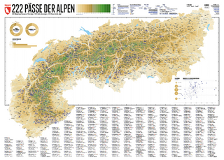
222 Mountain Passes of the Alps / 222 Cols des Alpes / 222 Passi …
Karte (gerollt) (2024)
Marmota Maps GmbH (Verlag)
CHF 84,90
Karte/Kartografie (2024)
Kompass-Karten (Verlag)
CHF 25,90
Und 20 besondere Wanderwege
Karte (gerollt) (2025)
Marmota Maps GmbH (Verlag)
CHF 84,90