Day Hikes Around Ventura County (eBook)
400 Seiten
Day Hike Books (Verlag)
978-1-57342-404-2 (ISBN)
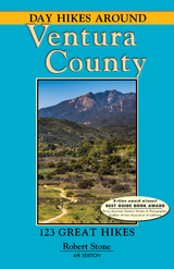
Ventura County is a scenic coastal county that lies just north of Los Angeles. The diverse topography includes national forest land, wilderness areas, mountain ranges, and over 50 miles of coastline. Miles of hiking trails weave through the open space, parks, forests, and coastal mountains that together form an ecological corridor. In addition, a network of trails are accessible within the metropolitan areas, where the open spaces have been thoughtfully integrated with the development. Day Hikes Around Ventura County is a collection of 123 of the countys best day hikes, providing access to both well-known and out-of-the-way greenspace. These hikes range from the Pacific Coast to the mountainous interior and forests. Highlights include coastal estuaries and tidepools, long beaches backed by bluffs, waterfalls, swimming holes, forested canyons, secluded creek paths, caves, ridge walks, historic sights, filming locations, and rugged outcroppings...from relaxing, scenic strolls to mountain-to-coast hikes with panoramic views. The large number of hikes provides an excellent cross-section of scenery and difficulty levels. Hiking times range from 30 minutes to seven hours. The majority of hikes are 13 miles in length. Relevant maps are listed under the the statistics to lengthen the hike if inclined. At least one map is included for every hike. The book is well organized by location and includes a thorough index with entries for points of interest. Companion guides include Day Hikes Around Los Angeles, Day Hikes Around Santa Barbara, and Day Hikes On the California Southern Coast.
Since 1991, Robert Stone has been writer, photographer, and publisher of Day Hike Books. He is a Los Angeles Times Best Selling Author and an award-winning journalist of the Rocky Mountain Outdoor Writers and Photographers, the Outdoor Writers Association of California, the Northwest Outdoor Writers Association, the Bay Area Travel Writers, and the Outdoor Writers Association of America. Robert resides summers in Red Lodge, Montana, and winters near Morro Bay, California.
Summerland • Carpinteria South Santa Barbara CountySummerland • Carpinteria Map (Hikes 1–6)1. Summerland Beach • Lookout Park2. Loon Point3. Carpinteria Salt Marsh Nature Park4. Tarpits Park—Carpinteria State Beach5. Carpinteria Bluffs Nature Preserve and Seal Sanctuary6. Rincon Point and Rincon Beach ParkOjai AreaOjai Area Map (Hikes 7–33)7 . Shoreline Lake Trail—Lake Casitas Recreation Area8. Murietta Canyon9. Matilija Creek Trail10. North Fork Matilija Creek Trail to Matilija Camp and Middle Matilija Camp—Southern Trailhead11. North Fork Matilija Creek Trail from Ortega Hill to Maple Camp and Upper Matilija Camp—Northern Trailhead12. Chorro Grande Trail to Oak Camp, Chorro Springs Camp, and Reyes Peak Camp13. Potrero John Trail14. Rose Valley FallsRose Valley Road Map (Hikes 14–19)15. Rose–Lion Connector Trail: Rose Valley to Lion Canyon16. Lion Canyon Trail to West Fork Lion Camp and East Fork Lion Camp17. Piedra Blanca Formations: Piedra Blanca Camp and Twin Forks Camp Gene Marshall–Piedra Blanca National Recreation Trail18. Sespe River Trail: Sespe Creek to Nordhoff Ridge Map (Hikes 14–20)19. Middle Sespe Trail—East Trailhead: Piedra Blanca Trailhead to Rock Creek20. Middle Sespe Trail—West Trailhead: Highway 33/Beaver Campground to Rock Creek21. Wheeler Gorge Nature Trail22. Rice Canyon–Wills Canyon Loop: Ventura River–Rancho El Nido Preserve23. Wills Canyon–Chaparral Crest Loop: Ventura River–Rancho El Nido PreserveNorth of Ojai Map (Hikes 24–29)24. Cozy Dell Trail to Cozy Dell Canyon25. Pratt Trail: Stewart Canyon to Valley View Camp—Stewart Canyon26. Pratt Trail to Foothill Trail–Cozy Dell Road Loop: Stewart Canyon • Cozy Dell Canyon27. Shelf Road: Signal Street to Gridley Road above Ojai28. Fuel Break Road–Shelf Road Loop: Stewart Canyon to Gridley Canyon29. Gridley Trail to Gridley Springs CampCentral Ojai Map30. Horn Canyon Trail31. Sisar Canyon32. Santa Paula Canyon33. Sulphur Mountain Road Recreation TrailVentura • Oxnard • Camarillo Pacific Coast–Santa Monica MountainsVentura to Point Dume Map (Hikes 34–69)Ventura–Oxnard Coastline Map (Hikes 34–42) 34 . Emma Wood State Beach and Seaside Wilderness Park: Ocean's Edge–River's Edge Loop35. San Buenaventura State Beach to the Ventura River Estuary36. San Buenaventura State Beach to Marina Park and Ventura Harbor37. McGrath State Beach: Santa Clara Estuary Natural Preserve38. Arroyo Verde Park39. Silver Strand Beach: Channel Islands Harbor to La Janelle Park40. Bubbling Springs Recreational Greenbelt41. Port Hueneme Beach Park42. Ormand Beach43. Mission Oaks Park TrailSanta Monica Mountains: Point Mugu State Park • Rancho Sierra Vista/Satwiwa Circle X Ranch • Leo Carrillo State ParkPoint Mugu to Decker Road Map (Hikes 44–64)Upper Point Mugu State Park • Rancho Sierra Vista/Satwiwa Map (Hikes 44–48)44. Wendy–Satwiwa Loop Trail: Rancho Sierra Vista/Satwiwa45. Ranch Overlook Trail–Satwiwa Loop: Rancho Sierra Vista/Satwiwa46. Boney Mountain Trail to Sycamore Canyon Falls: Rancho Sierra Vista/Satwiwa • Point Mugu State Park47. Old Boney Trail to Danielson Monument: Boney Mountain State Wilderness • Point Mugu State Park48. Big Sycamore Canyon Trail: Shuttle from Upper Trailhead to Lower Trailhead Rancho Sierra Vista/Satwiwa • Point Mugu State Park49. Chumash Trail–Mugu Peak Loop: Point Mugu State Park50. La Jolla Valley Loop from La Jolla Canyon: Point Mugu State Park51. Ray Miller–Overlook Fire Road–La Jolla Canyon Loop: Point Mugu State Park52. Scenic Trail–Overlook Fire Road Loop: Point Mugu State Park53. Serrano Valley Loop from Big Sycamore Canyon: Point Mugu State Park54. Serrano Valley from Serrano Road: Point Mugu State ParkCircle X Ranch Map (Hikes 55–58)55. Grotto Trail: Circle X Ranch56. Canyon View–Yerba Buena Road Loop: Circle X Ranch57. Sandstone Peak and Inspiration Point: Circle X Ranch58. Tri-Peaks: Mishe Mokwa–Sandstone Peak Loop: Circle X RanchLeo Carrillo State Park Map (Hikes 59–63)59. Yellow Hill Fire Road: Leo Carrillo State Park60. Lower Arroyo Sequit Trail and Sequit Point: Leo Carrillo State Park61. Ocean Vista: Willow Creek–Nicholas Flat Loop: Leo Carrillo State Park62. Nicholas Flat Trail: Nicholas Flat from the coast: Leo Carrillo State Park63. Nicholas Flat: Leo Carrillo State Park64. Arroyo Sequit Park65. Charmlee Wilderness Park66. El Pescador • La Piedra • El Matador State Beaches: Robert H. Meyer Memorial State Beach67. Newton Canyon Falls—Zuma/Trancas Canyons: Upper Zuma Canyon68. Newton Canyon—Zuma/Trancas Canyons • Castro Crest N.P.S.69. Rocky Oaks ParkThousand Oaks area Newbury Park to Simi HillsThousand Oaks Area Map (Hikes 70–111)Newbury Park–Thousand Oaks Open Space Trail System Map (Hikes 70–80)70. Dos Vientos Open Space71. Potrero Ridge Trail: Reino Road to Via Las Brisas72. Potrero Ridge Trail: Wendy Drive to Reino Road73. Los Robles Trail: Potrero Gate to Angel Vista Western Segment: Los Robles Trail System74. Los Robles Trail: Moorpark Gate to Angel Vista Central Segment: Los Robles Trail System75. Rosewood Trail to Angel Vista: Ventu Park Open Space • Los Robles Trail System76. Stagecoach Inn Museum and Nature Trail77. Oak Creek Canyon: Los Robles Trail System78. Los Padres–Los Robles Loop Los Padres/Los Robles Open Spaces: Los Robles Trail System79. White Horse Canyon Trail: South Ranch Open Space Los Robles Trail System80. Triunfo Canyon Trail: Conejo Ridge Open Space Los Robles Trail System81. Dawn's Peak: Conejo Open Space82. Conejo Valley Botanic Garden: Conejo Community ParkWildwood Park Map (Hikes 83–87)83. Lynnmere–Wildwood Canyon: East Loop • Wildwood Park84. Lynnmere–Wildwood Canyon: West Loop • Wildwood Park85. Paradise Falls: Moonridge Trail–Indian Creek Canyon Wildwood Park86. Lizard Rock: Mesa Trail–Stagecoach Bluff Loop Wildwood Park87. Mountclef Ridge: Santa Rosa Trail–Lower Butte Loop Wildwood Park • Mountclef Ridge Open SpaceWestlake Village • North Ranch Wood Ranch • Oak Park • Agoura HillsSimi Hills Open Spaces Map (Hikes 88–102)88. Hillcrest Open Space Preserve89. Sandstone Hills Trail to Vista Point East Trailhead: Sandstone Hills Trail–Oakbrook Vista Trail North Ranch Open SpaceUpper Simi Hills Map (Hikes 90–100)90. Oakbrook Regional Park to Vista Point West Trailhead: Oakbrook Vista Trail–Sandstone Hills Trail Oakbrook Regional Park • North Ranch Open Space91. Oakbrook Regional Park: Chumash Museum and Village92. Lang Ranch Loop from Lang Ranch Parkway: Lang Ranch Open Space93. Sunrise–Autumn Ridge Loop from Westlake Boulevard: Lang Ranch Open Space94. Sunset Hills–Woodridge Loop: Woodridge Estates • Sunset Hills Open Space95. Long Canyon–Sunrise Loop: Wood Ranch Open Space96. Canyon View Trail97. Coyote Hills–Wood Ranch Loop98. Challenger Park Loop99. Montgomery Canyon–Oak Canyon Loop Challenger Park • Wood Ranch Open Space100. Mount McCoy101. Oak Canyon Community Park102. Medea Creek ParkSimi Hills Cheeseboro/Palo Comado Canyons Upper Las Virgenes CanyonSimi Hills: Cheeseboro/Palo Comado Canyons Upper Las Virgenes Canyon Map (Hikes 103–111)103. China Flat Trail104. Upper Palo Comado–Cheeseboro Canyons Loop105. Cheeseboro Canyon to Shepherds' Flat106. Canyon View–Cheeseboro Canyon Loop107. Cheeseboro Ridge–Cheeseboro Canyon Loop108. Morrison Ranch Loop: Shea Open Space109. Upper Las Virgenes Canyon from the Las Virgenes Trailhead110. Upper Las Virgenes Canyon from the Victory Trailhead111. El Escorpion ParkLos Angeles County Simi Valley • Moorpark • FillmoreSimi Hills to Santa Susana Mountains Map (Hikes 112–123)112. Orcutt Ranch Horticulture Center113. Sage Ranch Park114. Stoney Point115. Old Santa Susana Stagecoach Trail: Santa Susana Pass State Historic Park116. Santa Susana Pass Loop: Santa Susana Pass State Historic Park117. Corriganville Park118. Rocky Peak Trail: Rocky Peak ParkRocky Peak Park Map (Hikes 118–121)119. Hummingbird Creek Trail: Rocky Peak Park120. Chumash Trail: Rocky Peak Park121. Las Llajas Canyon: Marr Ranch Parkland • Rocky Peak Park122. Happy Camp Canyon123. Tar CreekCompanion GuidesIndex
| Erscheint lt. Verlag | 1.3.2019 |
|---|---|
| Sprache | englisch |
| Themenwelt | Reisen ► Reiseführer |
| Schlagworte | Beaches • California • day hikes • Highway 101 • hike • Hiking • Los Angeles • Oxnard • Pacific • Santa Barbara • Santa Monica Mountains • Santa Susana • Ventura |
| ISBN-10 | 1-57342-404-8 / 1573424048 |
| ISBN-13 | 978-1-57342-404-2 / 9781573424042 |
| Informationen gemäß Produktsicherheitsverordnung (GPSR) | |
| Haben Sie eine Frage zum Produkt? |
Kopierschutz: Adobe-DRM
Adobe-DRM ist ein Kopierschutz, der das eBook vor Mißbrauch schützen soll. Dabei wird das eBook bereits beim Download auf Ihre persönliche Adobe-ID autorisiert. Lesen können Sie das eBook dann nur auf den Geräten, welche ebenfalls auf Ihre Adobe-ID registriert sind.
Details zum Adobe-DRM
Dateiformat: EPUB (Electronic Publication)
EPUB ist ein offener Standard für eBooks und eignet sich besonders zur Darstellung von Belletristik und Sachbüchern. Der Fließtext wird dynamisch an die Display- und Schriftgröße angepasst. Auch für mobile Lesegeräte ist EPUB daher gut geeignet.
Systemvoraussetzungen:
PC/Mac: Mit einem PC oder Mac können Sie dieses eBook lesen. Sie benötigen eine
eReader: Dieses eBook kann mit (fast) allen eBook-Readern gelesen werden. Mit dem amazon-Kindle ist es aber nicht kompatibel.
Smartphone/Tablet: Egal ob Apple oder Android, dieses eBook können Sie lesen. Sie benötigen eine
Geräteliste und zusätzliche Hinweise
Buying eBooks from abroad
For tax law reasons we can sell eBooks just within Germany and Switzerland. Regrettably we cannot fulfill eBook-orders from other countries.
aus dem Bereich