


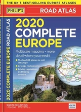
Philip's 2019 Complete Road Atlas Europe
(A4 with practical 'flexi' cover)
Seiten
2018
Philip's (Verlag)
978-1-84907-479-7 (ISBN)
Philip's (Verlag)
978-1-84907-479-7 (ISBN)
- Titel erscheint in neuer Auflage
- Artikel merken
Zu diesem Artikel existiert eine Nachauflage
Philip's: the UK's best-selling Europe Atlas range
'The clearest and most detailed maps of Europe' David Williams MBE, CEO Gem Motoring Assist
Special feature for 2019 'Driving Abroad - a cautionary tale' with dashcam examples
PHILIP'S: THE BEST-SELLING EUROPE ATLAS RANGE IN THE UK
Philip's: the UK's best-selling Europe Atlas range
The 300 greatest sights of Europe, plus Europe country-by-country special features
'The clearest and most detailed maps of Europe' David Williams MBE, CEO Gem Motoring Assist
Special feature for 2019 'Driving Abroad - a cautionary tale' with dashcam examples
Philip's 2019 Complete Road Atlas Europe has:
- Special Travel Feature: The top 300 places to visit in Europe
- Maps every country in Europe and Western Europe
- Main scale super-clear 1:750,000 (12 miles to 1 inch)
- Three supplementary scales from 1:250,000 to 1:3M - helps navigation in denser areas
- Practical A4 format - easy to use in the car
- 50 town and city plans
- 31 urban area maps
- Scenic routes highlighted
- 22-page route planning map section with 1,200 miles to a page
- Driving regulations country-by-country on European roads and local roads
- Ski resorts feature
- Distance chart
- Fully indexed
In fact, everything you need for your trip to Europe.
'The clearest and most detailed maps of Europe' David Williams MBE, CEO Gem Motoring Assist
Special feature for 2019 'Driving Abroad - a cautionary tale' with dashcam examples
PHILIP'S: THE BEST-SELLING EUROPE ATLAS RANGE IN THE UK
Philip's: the UK's best-selling Europe Atlas range
The 300 greatest sights of Europe, plus Europe country-by-country special features
'The clearest and most detailed maps of Europe' David Williams MBE, CEO Gem Motoring Assist
Special feature for 2019 'Driving Abroad - a cautionary tale' with dashcam examples
Philip's 2019 Complete Road Atlas Europe has:
- Special Travel Feature: The top 300 places to visit in Europe
- Maps every country in Europe and Western Europe
- Main scale super-clear 1:750,000 (12 miles to 1 inch)
- Three supplementary scales from 1:250,000 to 1:3M - helps navigation in denser areas
- Practical A4 format - easy to use in the car
- 50 town and city plans
- 31 urban area maps
- Scenic routes highlighted
- 22-page route planning map section with 1,200 miles to a page
- Driving regulations country-by-country on European roads and local roads
- Ski resorts feature
- Distance chart
- Fully indexed
In fact, everything you need for your trip to Europe.
Philip's has been at the forefront of creating maps and atlases since 1834. Whether a local street map or a fact-packed World Atlas, we use the most up-to-date technology, expertise and our global network to ensure our customers have all the information they need.
| Erscheinungsdatum | 10.05.2018 |
|---|---|
| Verlagsort | London |
| Sprache | englisch |
| Maße | 220 x 304 mm |
| Gewicht | 900 g |
| Themenwelt | Reisen ► Karten / Stadtpläne / Atlanten ► Europa |
| ISBN-10 | 1-84907-479-8 / 1849074798 |
| ISBN-13 | 978-1-84907-479-7 / 9781849074797 |
| Zustand | Neuware |
| Informationen gemäß Produktsicherheitsverordnung (GPSR) | |
| Haben Sie eine Frage zum Produkt? |
Mehr entdecken
aus dem Bereich


aus dem Bereich
Buch | Leporello (2025)
Kompass-Karten (Verlag)
CHF 21,90