GR20 Corsica (eBook)
272 Seiten
Cicerone Press (Verlag)
978-1-78362-354-9 (ISBN)
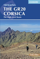
This guidebook describes the classic GR20 trek, the north to south traverse of the rugged mountains of Corsica. Starting in Corscia's north-west, in picturesque Calenzana, the route winds south-east, through the heart of Corsica, finishing on the eastern side of the island, just north of Porto Vecchio in the township of Conca. Described in 16 stages with high level/low level alternatives for relevant stages, the route is roughly 200km in length and takes approximately two weeks to complete. The GR20 climbs high into the mountains. It is demanding trek and only suitable for experienced walkers. Step-by-step descriptions of each stage are accompanied by 1:50,000 mapping, together with information on ascent/descent, terrain, and food, water and shelter en route. Also included is invaluable information such as path conditions, what to take, and getting to/from and around Corsica. This comprehensive guide also includes information on the history and geology of Corsica, together with notes on the local plants and wildlife. An island of surreal beauty, Corsica showcases dramatic mountains, enchanting coastline and ethereal vistas. Bare rock and sheer cliff contrasts with black sand beaches, alpine pastures and pockets of forest. Mediterranean flair abounds, history lingers and culture is celebrated, making it the perfect destination for a trek bursting with adventure.
Paddy Dillon is a prolific outdoor writer with over 70 guidebooks to his name, and contributions to 30 other publications. He has written for a variety of outdoor magazines, as well as many booklets and brochures for tourism organisations. Paddy lives near the Lake District and has walked in every county in England, Scotland, Ireland and Wales; writing about walks in every one of them. He enjoys simple day walks, challenging long-distance walks, and is a dedicated island-hopper. He has led guided walks and walked extensively in Europe, as well as in Nepal, Tibet, Korea, Africa and the Rocky Mountains of Canada and the United States.
Map key
Overview map
Route summary table
Introduction
Geology
Brief history
Getting to Corsica
Getting around Corsica
Getting to the GR20
When to trek
How to trek
Maps
Mountain weather
Path conditions
Mountain rescue
What to take
Services along the route
Food, drink and fuel
Language
Currency
Using this guide
Plants and wildlife on Corsica
Maquis
Trees
Flowers
Wildlife
The GR20
Stage 1A Calenzana to Refuge d'Ortu di u Piobbu (high-level)
Stage 1B Calenzana to Refuge d'Ortu di u Piobbu (low-level)
Excursion Ascent of Monte Corona from Refuge d'Ortu di u Piobbu
Stage 2A Refuge d'Ortu di u Piobbu to Refuge de Carozzu (high-level)
Stage 2B Refuge d'Ortu di u Piobbu to Refuge de Carozzu (low-level)
Stage 3 Refuge de Carozzu to Ascu Stagnu
Stage 4A Ascu Stagnu to Auberge U Vallone (main)
Stage 4B Ascu Stagnu to Auberge U Vallone (variant)
Link route Auberge U Vallone to Albertacce
Stage 5 Auberge U Vallone to Htel Castel di Vergio
Excursion Ascent of Paglia Orba from Refuge de Ciottulu di I Mori
Stage 6 Htel Castel di Vergio to Refuge de Manganu
Link route Bergeries de Vaccaghja to Corte
Link route Refuge de Manganu to Soccia
Stage 7 Refuge de Manganu to Refuge de Petra Piana
Link route Brèche de Capitellu or Bocca a Soglia to Bergeries de Grotelle
Excursion Ascent of Monte Ritondu from Refuge de Petra Piana
Stage 8A Refuge de Petra Piana to Refuge de l'Onda (low-level)
Stage 8B Refuge de Petra Piana to Refuge de l'Onda (high-level)
Link route Bergeries de Tolla to Tattone and Vizzavona
Stage 9A Refuge de l'Onda to Vizzavona (low-level)
Stage 9B Refuge de l'Onda to Vizzavona (high-level)
Stage 10 Vizzavona to Bergeries d' E Capanelle
Link route La Foce to Bocca Palmento
Stage 11A Bergeries d' E Capanelle to Bocca di Verdi (low-level)
Stage 11B Bergeries d' E Capanelle to Bocca di Verdi (high-level)
Stage 12 Bocca di Verdi to Refuge d'Usciolu
Link route Refuge d'Usciolu to Cozzano
Stage 13 Refuge d'Usciolu to Refuge de Matalza
Link route Tignosellu to Zicavo
Link route Zicavo to Refuge de Matalza
Stage 14 Refuge de Matalza to Refuge d'Asinau
Alt Stage 13/14 Refuge d'Usciolu to Refuge d'Asinau (variant)
Stage 15A Refuge d'Asinau to Village de Bavella (low-level)
Stage 15B Refuge d'Asinau to Village de Bavella (high-level)
Stage 16 Village de Bavella to Conca
Appendix A Facilities along the route (Calenzana to Conca)
Appendix B Facilities along the route (Conca to Calenzana)
Appendix C Accommodation list
Appendix D Basic language notes
Appendix E Useful contacts
Normal
0
false
false
false
EN-GB
JA
X-NONE
/* Style Definitions */
table.MsoNormalTable
{mso-style-name:"Table Normal";
mso-tstyle-rowband-size:0;
mso-tstyle-colband-size:0;
mso-style-noshow:yes;
mso-style-priority:99;
mso-style-parent:"";
mso-padding-alt:0cm 5.4pt 0cm 5.4pt;
mso-para-margin:0cm;
mso-para-margin-bottom:.0001pt;
mso-pagination:widow-orphan;
font-size:12.0pt;
font-family:Cambria;
mso-ascii-font-family:Cambria;
mso-ascii-theme-font:minor-latin;
mso-hansi-font-family:Cambria;
mso-hansi-theme-font:minor-latin;}
| Erscheint lt. Verlag | 23.6.2016 |
|---|---|
| Zusatzinfo | 97 photos, 73 maps and 47 route profiles |
| Verlagsort | Milnthorpe |
| Sprache | englisch |
| Themenwelt | Sachbuch/Ratgeber ► Sport |
| Reisen ► Reiseführer | |
| Schlagworte | Backpacking • Europes toughest trek • hike • Walk |
| ISBN-10 | 1-78362-354-3 / 1783623543 |
| ISBN-13 | 978-1-78362-354-9 / 9781783623549 |
| Informationen gemäß Produktsicherheitsverordnung (GPSR) | |
| Haben Sie eine Frage zum Produkt? |
Kopierschutz: Adobe-DRM
Adobe-DRM ist ein Kopierschutz, der das eBook vor Mißbrauch schützen soll. Dabei wird das eBook bereits beim Download auf Ihre persönliche Adobe-ID autorisiert. Lesen können Sie das eBook dann nur auf den Geräten, welche ebenfalls auf Ihre Adobe-ID registriert sind.
Details zum Adobe-DRM
Dateiformat: EPUB (Electronic Publication)
EPUB ist ein offener Standard für eBooks und eignet sich besonders zur Darstellung von Belletristik und Sachbüchern. Der Fließtext wird dynamisch an die Display- und Schriftgröße angepasst. Auch für mobile Lesegeräte ist EPUB daher gut geeignet.
Systemvoraussetzungen:
PC/Mac: Mit einem PC oder Mac können Sie dieses eBook lesen. Sie benötigen eine
eReader: Dieses eBook kann mit (fast) allen eBook-Readern gelesen werden. Mit dem amazon-Kindle ist es aber nicht kompatibel.
Smartphone/Tablet: Egal ob Apple oder Android, dieses eBook können Sie lesen. Sie benötigen eine
Geräteliste und zusätzliche Hinweise
Buying eBooks from abroad
For tax law reasons we can sell eBooks just within Germany and Switzerland. Regrettably we cannot fulfill eBook-orders from other countries.
aus dem Bereich