


Maxi Scale Britain
Seiten
2002
|
Revised edition
Automobile Association (Verlag)
978-0-7495-3415-8 (ISBN)
Automobile Association (Verlag)
978-0-7495-3415-8 (ISBN)
- Titel erscheint in neuer Auflage
- Artikel merken
Zu diesem Artikel existiert eine Nachauflage
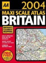
This atlas of Britain features clear road mapping, an AA EuroRAP (European Road Assessment Program) risk rating map - the safest roads are shown in green and the most dangerous in black; a district map of Greater London and M25 and M60 Manchester orbital motorway maps. Motorways, primary routes, A and B roads and primary routes are highlighted.
| Erscheint lt. Verlag | 1.7.2002 |
|---|---|
| Reihe/Serie | AA Atlases S. |
| Zusatzinfo | all colour maps |
| Verlagsort | Basingstoke |
| Sprache | englisch |
| Maße | 302 x 390 mm |
| Gewicht | 1060 g |
| Themenwelt | Reisen ► Karten / Stadtpläne / Atlanten ► Europa |
| ISBN-10 | 0-7495-3415-X / 074953415X |
| ISBN-13 | 978-0-7495-3415-8 / 9780749534158 |
| Zustand | Neuware |
| Informationen gemäß Produktsicherheitsverordnung (GPSR) | |
| Haben Sie eine Frage zum Produkt? |
Mehr entdecken
aus dem Bereich


aus dem Bereich
Buch | Leporello (2025)
Kompass-Karten (Verlag)
CHF 21,90