


Collins Road Atlas
Seiten
1995
|
Revised edition
HarperCollins Publishers Ltd (Verlag)
978-0-00-448153-1 (ISBN)
HarperCollins Publishers Ltd (Verlag)
978-0-00-448153-1 (ISBN)
- Titel erscheint in neuer Auflage
- Artikel merken
Zu diesem Artikel existiert eine Nachauflage
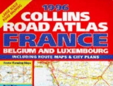
An updated road atlas of France. The mapping covers all of France, Belgium and Luxembourg at a scale of 3.5 miles to 1 inch. Greater Paris is shown at 1.25 miles to 1 inch, and Central Paris at 2.4 inches to 1 mile. It includes a town plan of Bruxelles, Lyon and Marseille.
| Erscheint lt. Verlag | 2.3.1995 |
|---|---|
| Zusatzinfo | colour maps, index |
| Verlagsort | London |
| Sprache | englisch |
| Maße | 286 x 390 mm |
| Gewicht | 1 g |
| Themenwelt | Reisen ► Karten / Stadtpläne / Atlanten ► Europa |
| ISBN-10 | 0-00-448153-4 / 0004481534 |
| ISBN-13 | 978-0-00-448153-1 / 9780004481531 |
| Zustand | Neuware |
| Informationen gemäß Produktsicherheitsverordnung (GPSR) | |
| Haben Sie eine Frage zum Produkt? |
Mehr entdecken
aus dem Bereich


aus dem Bereich
Buch | Leporello (2025)
Kompass-Karten (Verlag)
CHF 21,90