


Collins Road Atlas
Seiten
1996
|
Revised edition
Collins (Verlag)
978-0-00-448374-0 (ISBN)
Collins (Verlag)
978-0-00-448374-0 (ISBN)
- Titel erscheint in neuer Auflage
- Artikel merken
Zu diesem Artikel existiert eine Nachauflage
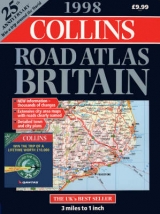
This revised edition contains large scale, easy-to-read maps of the roads of Britain. There are 21 pages of detailed urban area maps of the major population centres, 58 city and town centre plans, and an eight-page section of maps and plans covers the M25, Greater, and Central London.
The road maps, mostly at 3.2 miles to 1 inch feature a road classification system showing clear distinction between trunk roads, primary routes and "A" roads. In addition the maps include many minor roads with passing places, railway lines and tourist information. An eight-page section of London maps and plans covers the M25 and Greater and Central London. The atlas is colour coded for easy reference enabling each section to be readily identified and the spiral binding allows the atlas to be opened flat for easy route following. A year planner showing major events of motoring interest and an index to all major places of interest are also included, as well as a wipe-clean journey planner.
The road maps, mostly at 3.2 miles to 1 inch feature a road classification system showing clear distinction between trunk roads, primary routes and "A" roads. In addition the maps include many minor roads with passing places, railway lines and tourist information. An eight-page section of London maps and plans covers the M25 and Greater and Central London. The atlas is colour coded for easy reference enabling each section to be readily identified and the spiral binding allows the atlas to be opened flat for easy route following. A year planner showing major events of motoring interest and an index to all major places of interest are also included, as well as a wipe-clean journey planner.
| Erscheint lt. Verlag | 16.9.1996 |
|---|---|
| Zusatzinfo | maps, index |
| Verlagsort | London |
| Sprache | englisch |
| Maße | 305 x 384 mm |
| Gewicht | 1 g |
| Themenwelt | Reisen ► Karten / Stadtpläne / Atlanten ► Europa |
| ISBN-10 | 0-00-448374-X / 000448374X |
| ISBN-13 | 978-0-00-448374-0 / 9780004483740 |
| Zustand | Neuware |
| Informationen gemäß Produktsicherheitsverordnung (GPSR) | |
| Haben Sie eine Frage zum Produkt? |
Mehr entdecken
aus dem Bereich


aus dem Bereich
Buch | Leporello (2025)
Kompass-Karten (Verlag)
CHF 21,90