


Philip's Street Atlas: North Hampshire
Seiten
2002
Philip's (Verlag)
978-0-540-08103-5 (ISBN)
Philip's (Verlag)
978-0-540-08103-5 (ISBN)
- Titel erscheint in neuer Auflage
- Artikel merken
Zu diesem Artikel existiert eine Nachauflage
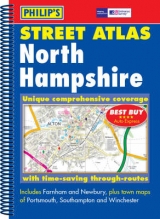
This revised edition atlas shows every street in North Hampshire with postcode boundaries, at a scale of 3 inches to 1 mile. Designed for business and leisure use, it has a route-planning map and administrative map, as well as a comprehensive index of street names, postcodes, schools and more.
| Erscheint lt. Verlag | 25.3.2002 |
|---|---|
| Verlagsort | London |
| Sprache | englisch |
| Maße | 194 x 271 mm |
| Gewicht | 520 g |
| Themenwelt | Reisen ► Karten / Stadtpläne / Atlanten ► Europa |
| ISBN-10 | 0-540-08103-5 / 0540081035 |
| ISBN-13 | 978-0-540-08103-5 / 9780540081035 |
| Zustand | Neuware |
| Informationen gemäß Produktsicherheitsverordnung (GPSR) | |
| Haben Sie eine Frage zum Produkt? |
Mehr entdecken
aus dem Bereich


aus dem Bereich
Buch | Leporello (2025)
Kompass-Karten (Verlag)
CHF 21,90