


Navigator Road Map Cornwall
2002
Philip's (Verlag)
978-0-540-08038-0 (ISBN)
Philip's (Verlag)
978-0-540-08038-0 (ISBN)
- Titel erscheint in neuer Auflage
- Artikel merken
Zu diesem Artikel existiert eine Nachauflage
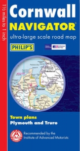
This Philip's ultra-large-scale navigator map is designed to be used by professionals and leisure users. The index is printed on the same side as the map itself for ease of wall hanging. The detail includes many individually-named houses. There are town plans of Plymouth and Truro.
A brand new sheet map featuring Philip's exceptionally largescale and detailed Navigator mapping and covering the whole of Cornwall and City of Plymouth. The map is part of Philip's new series of Navigator sheet maps, each covering a county, unitary authority, or group of authorities. The map gives highly detailed coverage at 1 mile to 1 inch of the region's road network, including minor country lanes and rural tracks - and even major footpaths - and every junction, roundabout and slip-road is shown in detail. There is much other detail, including thousands of individually named farms, houses and hamlets. Also shown are airports, airfields, stations, ferries, canals, marinas and an abundance of places of interest. The map has a comprehensive index and includes town plans of Plymouth and Truro. The maps are designed for both professional and leisure users. For professionals, the wealth of detail makes activities such as regional planning and delivery driving far casier. Also, the maps are fully printed on one side (including the index) to allow hanging as a wall map.
For leisure, the wealth of detail greatly eases the navigation of both main roads and byways, and increases the pleasure of touring by opening up new possibilities.
| Erscheint lt. Verlag | 18.4.2002 |
|---|---|
| Reihe/Serie | Navigator |
| Zusatzinfo | index |
| Verlagsort | London |
| Sprache | englisch |
| Maße | 131 x 253 mm |
| Gewicht | 90 g |
| Themenwelt | Reisen ► Karten / Stadtpläne / Atlanten ► Europa |
| ISBN-10 | 0-540-08038-1 / 0540080381 |
| ISBN-13 | 978-0-540-08038-0 / 9780540080380 |
| Zustand | Neuware |
| Informationen gemäß Produktsicherheitsverordnung (GPSR) | |
| Haben Sie eine Frage zum Produkt? |
Mehr entdecken
aus dem Bereich


aus dem Bereich
Karte (gefalzt) (2024)
Freytag-Berndt und ARTARIA (Verlag)
CHF 18,95
Georgien, Armenien, Aserbaidschan
Karte (gefalzt) (2025)
Freytag-Berndt und ARTARIA (Verlag)
CHF 24,90
markierte Wanderwege, Hütten, Radrouten
Karte (gefalzt) (2023)
Kompass-Karten (Verlag)
CHF 26,90